Motorcycle adventures

Welcome to my Blog!

image_pdf

Singapore to London

I’m planning to ride my motorcycle from Singapore to Europe starting April/May this year, 2019. I will go through Malaysia, Thailand and Laos before joining a group ride through western China. After a month in China riding through Tibet I will enter Kirghistan. Then into Kazakhstan and further towards Europe.


This will be a long trip and there’s lot’s of stuff to prepare.  I will be going through many countries and visa requirements will vary from country to country.  There are also preparations to do for the bike.

Read more


Singapore to Laos

The first part of the trip was easy with no visas or other paperwork needed and went from Singapore through Malaysia, Thailand and Laos.

Read more


Laos to Lhasa, Tibet

We rode 3200 km to Lhasa through amazing and scenic landscapes gradually ascending to an elevation of around 4000m.

Read more


Lhasa to Kashgar

The highlight of this stretch was undoubtedly Mount Everest base camp but there were many other exciting sights as well.

Read more


Silk Road


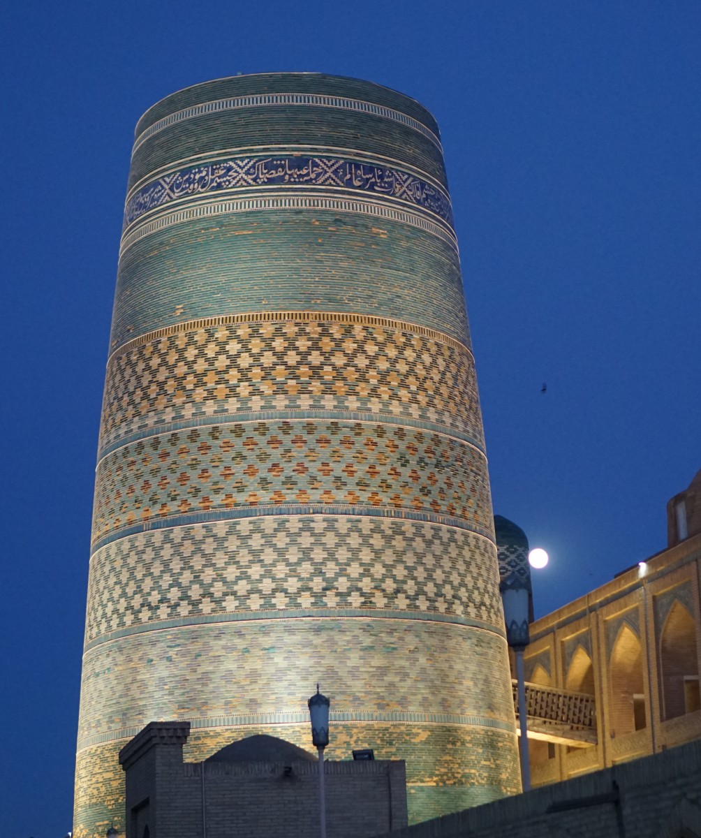
Once out of China the real adventure starts!  Kirghistan starts off as a bit of a bad dream, but Uzbekistan through Samarkand is amazing while the route through Kazakhstan is more of a transport stretch.  

Read more


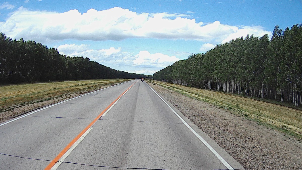
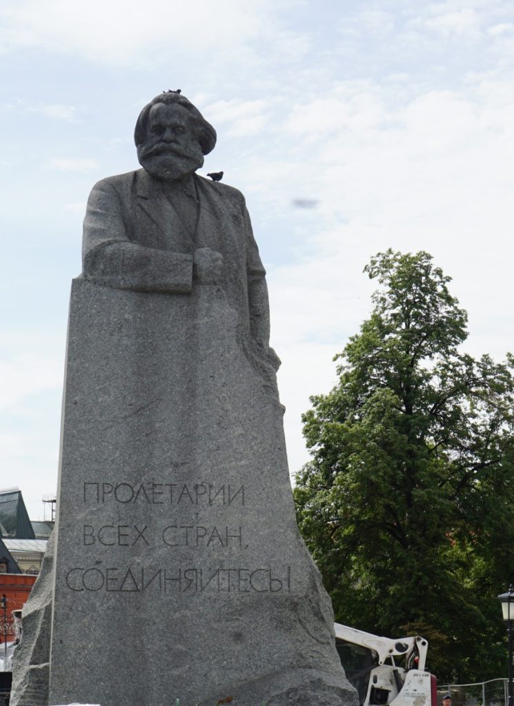
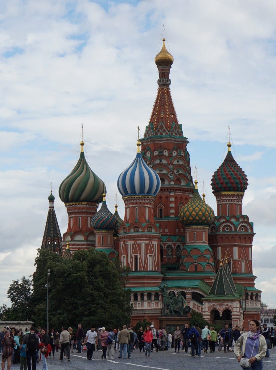
Astrakhan, Volgograd, Moscow and onward to London

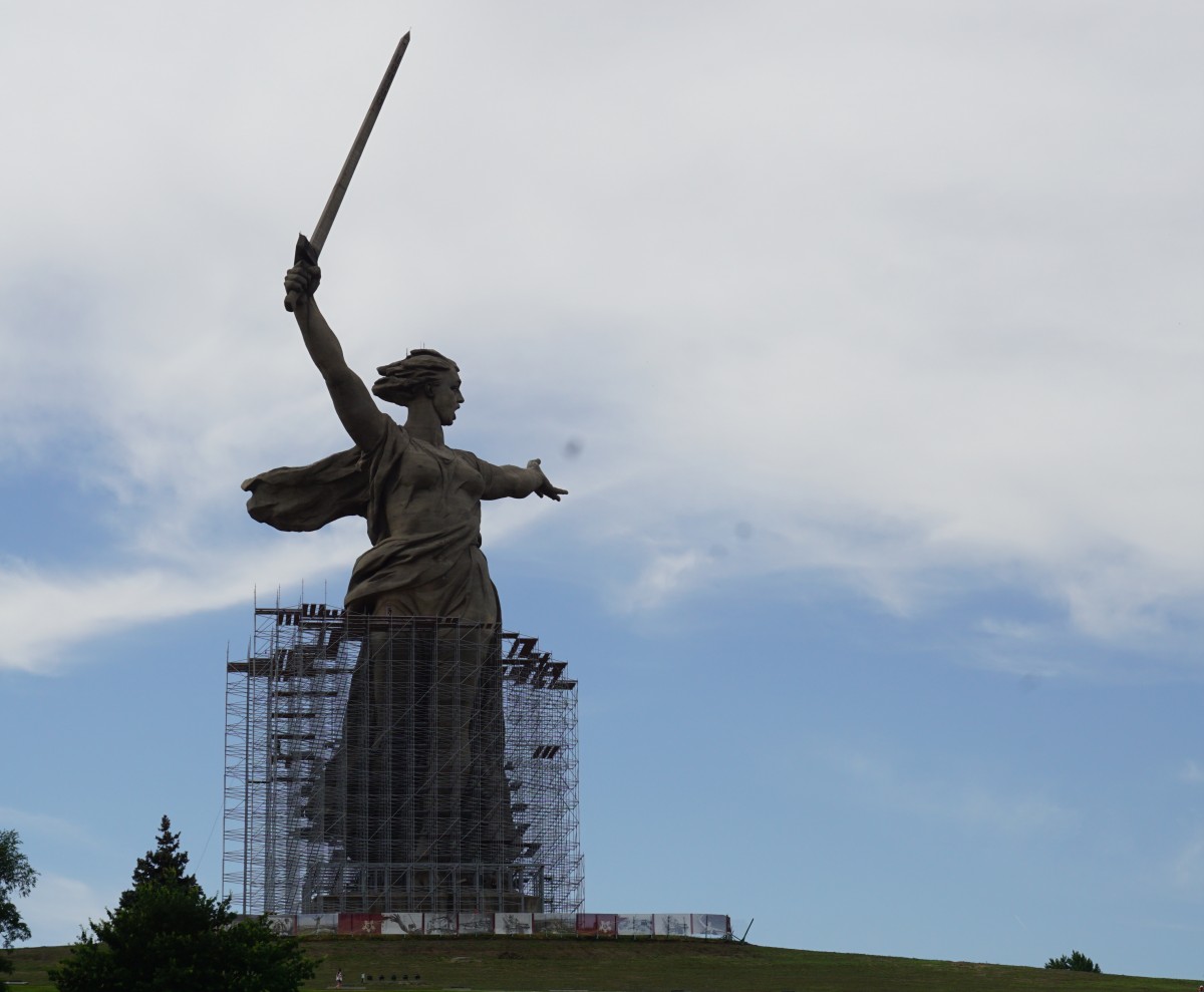
Russia turned out to be a lot nicer than it’s reputation and I particularly enjoyed Volgograd.  Of course, Moscow was amazing and I got to see the famous buildings we often see on the news.  After a ferry across the Baltic I spent some time in Sweden before going to London and the end of my adventure.

Read more

South America 24 : Day 37

Go to South America 24: Day 29Go to South America 24: Day 22Go to South America 24 Day 1

Day 37: El Calafate

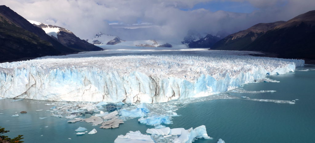
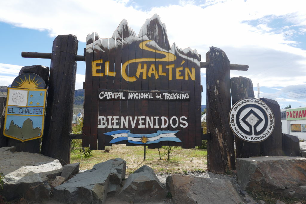
Afer a great day of hiking in El Chalten I rode to El Calafate, the town that is the gateway to the Perito Moreno glacier. A bit over 200 kms between the two towns and tarmac’ed the whole way. I found a hostel that had off street parking for the bike and had a private room available. It’s pretty basic with a minimal kitchen, however, it has heated flooring! Very nice.  After sleeping rather badly, I rearranged the loading of the bike for a return trip to the Perito Moreno glacier staying at the same hostel for two nights. The glacier is 250 sqr kms in size and together with the 47 other glaciers in the area holds 1/3 of the freshwater in the world! The glacier is nor shrinking or expanding meaning it is fed the same amount of snow as it is loosing, The glacier grows in the months of June through December and recedes between December and April. Glacioligists debates the reason for the glacier being in equilibrium with other glaciers in the world, often, shrinking.

The height of the ice at the highest point is 70m. The glacier advances two meters every day, and calves every minute and I heard several of these events giving up an almighty roar every time. Very impressive!After spending 3.5 hours at the site I packed the bike and rode back to El Calafate and the hostel.

Day 39: Puerto Natales

After the impressive glacier sightings, I moved on towards the south and Puerto Natales, which is the gateway to the Chilean “equivalent” of El Chalten, Torres del Paine. Along the way I see a lot of Guanacos which is a smaller relative of the domesticated Llama. There are fences 50m on either side of the road but the Guanacos get over them easily and often forage close to the road. They get to be 1.2 m tall and weigh close to 100 kg so you definitively do not want to hit one. I need to relax some more so I will definitively stay two nights at this nice hotel like hostel, Sendero.

I have plans to make a day-trip to Torres del Paine, but unfortunately, it’s raining quite heavily today and the forecast for the next few days does not look promising so I’ll spend my time in front of the Woodburner.

Day 41: Cerro Sombrero

With no good weather in the forecast for the next few days, I got on the bike and rode to Tierra del Fuego. It was a very windy day which made riding feel dangerous with the bike tilted over one way for all of a sudden the wind changing direction making the bike tilt the other way. Not enjoyable riding at all!To get to tierra del fuego you must take a ferry and I chose the shorter and more regular option leaving the mainland at Punta Delgado. While waiting for the ferry to arrive the wind was very strong and I was worried the bike would be blown over. Scary stuff you never think of when traveling in a car.After an hour the ferry arrived and it was really struggling against the wind to get to the loading position. On board the ferry without problems I had an hour for some refreshments before getting off on Tierra del Fuego.

I carried on until I got to Cerro Sombrero where I stopped to fill the tank. I asked the attendant the directions to a hotel and I found a really nice and cozy one, hosteria Tunkelen, and they had a room. I had dinner with a guy who is organizing motorcycle tours in South America. He was returning from Ushuaia after having guided a group of bikers on a 23 day trip. He would soon be guiding a group of Italian bikers organized through Dainese. This was his job! The envy of many bikers, I’m sure!

Hosteria Tunkelen

Day 42: Ushuaia

I was considering staying another day at Tunkelen hosteria and wait for a less windy day, but in the end I decided to go, It’s a 400 km ride, first through Chile and then Argentina. It was very windy until the last 100 kms, with the last 50 kms going through mountainous terrain over Paso Garibaldi, and, of course, it started raining and the temperature sank to 4C. It was so cold on the bike! But I made it πŸ™‚

I rode around town to find somewhere to stay and in several places they were full, I finally found a 2-star hotel close to the center, Hotel Vitalia.

The Yamana people were the first inhabitants of the island and were, perhaps, in some respects similar to Eskimos, in that they lived in a pretty harsh environment. Apart from one difference – they didn’t wear clothes!

They used bonfires to keep warm and when Magellan came there in 1520 he saw the fires and named the island Tierra del Fuego! With more European influence the indigenous people started to suffer, wearing clothes meant that their hygiene got worse and many caught European illnesses such as measles and perished.

Eventually the Argentines settled the area and built a jail for serious criminals, which has now been converted to a museum where I got the picture of the Yamani people. Ushuaia is today a prosperous city of 80,000 people.Weather is mild with average -1 degrees in the dead of winter.Tourism is a big part of the economy with cruise ships often seen in the harbor.

For dinner I joined up with Olav, a biker friend, who I last met in Tibet close to 5 years ago. We’ve kept in touch via Facebook and as it happened we were in Ushuaia at the same time. Olav is here with a group of bikers and his friend Jeff also joined for dinner.
It was a very enjoyable meal where we discussed many world problems as well as the success of Taiwan in chip making and the incredible progress Singapore has made over the last fifty years.

Day 44: Cerro Sombrero

I stayed in Ushuaia for two days and then started on the ride back north. It was cold and very wet for a while, and later on strong winds. When I arrived at the hotel I was frozen to the bone and not even a hot bath could revive the circulation in my feet. Oh dear, the pleasures of adventure riding πŸ€”At dinner I chatted to a group of bikers and understood that one of the riders had crashed and was at the local clinic being checked out. He had no broken bones but was in some pain. Luckily, the group had a follow-along truck and he would be riding there rather than on his bike. I decided to stay for an extra day to thoroughly warm up and consider my plans.

In the morning I talked to my 8 year old girl and when I told her it was possible to end the trip and come home within a week she said, yeah!I missed you!

I have been told by many that the trip north along Ruta 3 is incredibly boring and 3000 kms in distance.Taking everything into consideration I decided to end the trip in Punta Arenas where the bike will be trucked to Santiago and then shipped to Singapore.

Day 46: Punta Arenas

The ride of the 200 kms was very cold and windy with a temperature at the start of 5c. There was nowhere to warm up until 160kms along the way, and I was really glad to stop for an empanada and hot coffee and warm up by a radiator!

In Punta Arenas I had to find a notary to make a power of attorney allowing my shipping agent to handle customs on my behalf when shipping the bike to Singapore. There are many notaries in every town and it didn’t take long to find one and get the required document.Then off to the trucking depot where I left the bike after packing all my bike clothes on the bike leaving me with only cabin luggage for the flights back to Singapore.

The next day I walked around town for a while before getting to the airport and the flight to Santiago.

The flight is 3 and a half hours reflecting the distance I’ve covered which was 6000kms! Quite a way.


Progress to Ushuaia and back to Punta Arenas.


Day 47: Santiago

I landed in Santiago and found a Best Western hotel in the Centro area.  The hotel room is nice but the localtion not so great with no restaurents or caffes anywhere near.  Neither is the hotel at a safe area and I was told to stay inside after dark which kind of meant I had to have dinners at the hotel.  For the next three datys I did some sightseeing but saw nothing very exciting.  


After 3 days in Santiago it was time to get on the plane to Houston, followed by legs to San Fransisco and Singapore.  The last leg is a 17 hour killer flight.  Not much fun being stuck in a chair for that long.


South America 24: Day 29

South America 24: Day 22

Go to South America 24 ; Day 1

Go to South America 24 : Day 37

Mirlo’s hostel in Futaleufu is nice, great kitchen and very comfortable bed. And I slept through the snoring, yay! A good night’s sleep makes all the difference!


Day 29: Puyuhuapi

I joined up with Felipe and Jorge and we ride together to a place along the Carretera Austral, Puyuhuapi. It’s a small town at the northern end of a fjord, ie. at sea level. The first 50 or so kms were on a dirt road but a much better one than the two I’ve seen so far. I’m kind of getting the hang of riding on these with the feeling of floating, and when the speed is 70 to 80 the bike skims over and loses the reverberations that are very bad when you go slower. Motorcycling is all about confidence and overcoming your fears.


Narrow bridge with nice scenery.


After 50 kms of dirtroad we turned south on Chile 7, which is the Carretera Austral.   This road was ordered to be built by Pinochet in 1976 and is 1270 kms long starting in Puerto Montt and ends in Villa O’Higgins.  Most of the northern part is tarmac while further south it is mainly gravel road which I got to experience the next few days.  But today’s ride on the Carretera Austral was all on paved surface so we could keep a good speed.  We arrived in Puyuhuapi early afternoon and discovered it’s located at the end of a fjord.  I decided to try camping for a night and we found a campsite with a roof cover. 


After unpacking and setting up the tents we went for a walk in the neighbourhood and we bought beer and was consuming it while sitting on a park bench. After a while the town police car stopped and the policeman came out and said that open consumption of alcohol was not permitted.   We sheepishly walked back to the campsite where we could down the remaining beer. 

Felipe and Jorge cooked a vary nice dinner which we ate with a bottle of nice wine.


Tried to get some sleep  but people were talking loudly and laughing at 11.30pm, I got a bit upset so I got up and gave the loud people a talking to πŸ™‚  Next morning I see a sign where it says quiet from  midnight so I felt bad about it.  Oh well.  Anyway, sleeping in a tent does not seem to be for me, I could not sleep at all!  I’m too used to a comfortable bed.


Day 30: Coyhaique


After some discussion over lunch we set off after 1pm, going south on Ruta 7 with the plan to go to Coyhaique.  For a long time it was a miserable day with rain and wet roads.  There was a long stretch of dirt road and a particularly challenging part was going up a steep hill with numerous very sharp switchbacks of treacherous gravel.  At one 180 degree turn my rear wheel slid quite a bit, I was alright but my heart skipped a beat!  After that the road was tarmac’ed the whole way and the rain gradually stopped.


We stopped at a few vantage points but with fog and low hanging clouds there was not much to see.


After crossing a bridge Felipe stopped and pointing back to a sign for a waterfall and we made U-turns going back to look at the beautiful cascaded waterfall.  Very nice!

After arriving at Don Tito’s guest house and getting installed, we met up at a nearby beer place before going to eat at a very busy restaurant.  I ordered something I didn’t understand what it was and it turned out to be raw beef on toast, it was actually very nice but I was afraid that I’d have stomach problems the next day


Day 31: Puerto Rio Tranquilo

I split up from Felipe and Jorge who had plans to do hiking for a few days and decided to carry on south after a very lazy morning. I slept really well at the Don Tito bed an breakfast and was in no rush to get going. 

After packing everything, I went to get Sleipner who was parked at an awkward place, where the host wanted me to park to make room for the cars of more guests.  Well, it didn’t go so well and I ended up dropping the bike in an enclosed space against the house making it very difficut to get a good grip to raise it.  I asked the host for help but we couldn’t right it.  He had to call a friend who came around and helped to get Sleipner rightside up.  No big deal, nothing broken on either bike nor me…  I thanked them both deeply for being so kind.


After all this I didn’t get going until noon and set off south on the caretera Austral.  The first 100 kms were easy along a nice tarmac’ed surface but then the gravel road took over.  The first bit was surface prepared to lay tarmac on which, as I said before, isn’t easy to ride on.  At one stretch a road planing machine had created a ridge of 30 cm of gravel and I chose to ride on the unplaned side but after a while there was no more road left and I was stuck on the side of the high ridge but couldn’t get through.  Fortunately, a car driver saw my trouble, stopped the car and came out to give me a push to get through the ridge.  Phew! If not I would have been stuck!  What a nice guy!  Two guys giving me much needed help in one day!  Amazing!  From then on it was all gravel road and pretty slow going.  However, rewardingly, the landscape was fantastic with amazing views.


After 150 kms of gravel road the time was approaching 5 pm and I was ready to stop for the day.  Fortunately, I came to a small, but touristy town, with a hotel and they had a room.  The name of the village had a poetic ring to it – Puerto Rio Tranquilo…


Day 32: Bajo Caracoles


I got up pretty early and did some work on the bike, some screws for the windscreen were coming loose and a bolt holding up the exhaust canister had come off so I used a temporary fix to hold it up.  Not so pretty but it’ll do!

After breakfast I managed to get going at 9 am.  I knew the road to the border with Argentina was not going to be fast or easy being gravel the whole way.  Some stretches were easy and some pretty technical.  The rutts are always bad when going uphill and there were a lot of those, the rutts are so bad that the traction control (before I knew how to set it properly) would kick in and almost make the bike stop and making it necessary to change down a gear.  There were road works in stretches making the surface very difficult to maneuver – but I got through.  The reward for my struggles was the amazing views.  After 4 hours I reached Chile Chico, right on the border with Argentina.  160 kms of gravel road in 4 hours gives an average speed of 40 kph, good or bad?  Who knows and who cares?

After a quick lunch I crossed the border and found very good roads and did 200 kms before stopping at Bajo Caracoles.  I used to use Booking.com to reserve a room but haven’t done that the last week.  I found that booking.com’s price is higher than what I can get on the spot and also I don’t know beforehand the road conditions and whence not how far I can go in a day.


Scenic views from today’s ride


Very basic hotel in Bajo Caracoles


The hotel in Bajo Caracoles was very basic and pretty expensive for what it was.  They can charge that much because there is nothing else for hundreds of kms.  I rode 200 kms from the first town in Argentina, Perito Moreno, and there was no human settlements anywhere to be seen. 


Day 33: Gobernador Gregores 

This place, with the rather strange name, is around 250 kms from Bajo Caracoles along Ruta 40.  Asphalt the whole way apart from some short stretches of dirt.  I stopped to get some fuel and coffee and happily set off to go as far as I could towards El Chalten.  Unfortunately, I didn’t take a turn where I should have and rode a long way before I saw my mistake.  I decided to go back and hit very strong head winds making the return trip very arduous.

Back in Gobernador Gregores, I found a hotel and, later, had a nice meal.  After a good night’s sleep I decided to take a rest day, update my blog and  watch the F1 race – if possible.  After many days of riding I need to get my clothes washed and after walking along the street looking for a laundry place I reach the petrol station and I ask the lady at the counter where I can get my clothes washed, she says she can do it!  Amazing!  I can pick them up after 8pm.

Day 35: El Chalten

Woke up pretty early to start the trip to El Chalten.  I knew there was a bad stretch of road that could take a long time to navigate.  After 65 kms of tarmac I entered this infamous section od Ruta 40, named β€œMaldite 73” (Damn 73 in English) in the iOverland app, feeling pretty confident it wouldn’t be much of a problem.  It started pretty well but after some kms I entered a section with deep gravel, the bike started drifting, I couldn’t straighten it up and down I went.  Observing the bike on the road I found no damage on either the bike or myself.  There is no way I can lift the bike up myself so I had to wait for help to arrive.  This is a very desolate stretch of road and I had to wait 10 or 20 minutes before a couple of cars arrived and several guys came out and helped me righten the stricken β€œwhale”.  After that I hopped straight on the bike and got going.  However, confidence always takes a hit when I crash and with that I tense up and also loose the feeling of the bike so I started very slowly.  Suffice it to say, the rest of the stretch, some 70 kms, was a nightmare πŸ™  

Beached Hinda


The day before I met some bikers at Gobernador Gregores and they were going to ride 300 kms and one day extra to avoid the bad stretch, at the time I couldn’t understand why, but now I certainly could.  After close to 4 hours I got through the bad section and could run at normal speed until reaching El Chalten.  


I quickly found a hostel, and at first, balked at the price it was charging, 3 times as much as the room in Gobernador Gregores for a worse room, but had no choice but to accept.  It’s still about the same price I would pay for any hotelroom in Sweden so really no big deal.  El Chalten is a resort town and they can charge a lot and people will still come.  


Start of the trail

After a really good night’s sleep I decided to stay another day and go hiking to a lake with good views of Fitzroy.  After a few kms of the hike there was a viewpoint and I sat down on a bench and asked the woman sitting there where she was from.  Singapore she answered!  With that we started talking and her husband turned out to have been a professor at NTU (university in Singapore), who had just retired, I told him my wife received her PhD from there.  He immediately was interested to know which subject she had chosen and it turned out not to be his, anyway, it was a really nice conversation and we wished each other luck for the hike.

At another rest stop I ran into a group and they asked where I was from and I said Sweden.  A woman then said that the football team Boca Juniors had chosen their colors based on the Swedish flag ones.  OK, strange…  I then ran into a group of four americans and when I was told they were from Minnesota I said that people there were mainly from the no​rdic countries, I walked with them for a while until we came to a spot with amazing clear views of Fitzroy and we helped each other with photos.  After some more steps I could hear the beautiful language of Swedish being spoken and, of course, I started chatting to the couple discussing which route they should choose.  They were taking buses between various places and were full of praise for Argentina.

Once reaching the lake which was the goal of the hike, I got some very nice pictures of the famous β€œW”,  Mt Fitzroy, mountain, before starting the hike back.

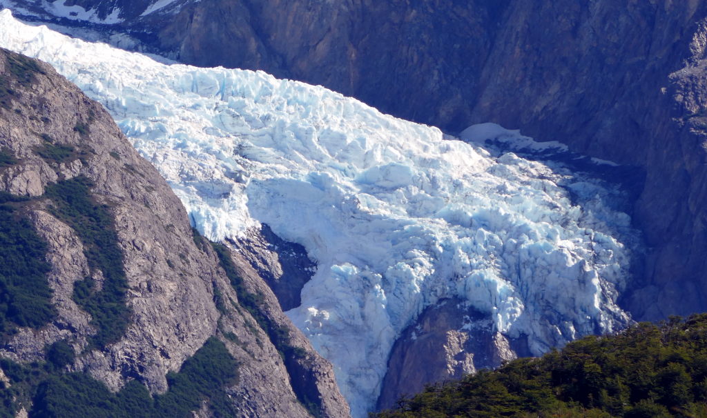
In the far distance I could make out a glacier that was spilling out into a steep gorge.

Later I ran into a couple where the man was carrying their 8 month old baby sitting in a back pack, I saw the baby was wearing ear-studs and asked if they had made holes for them.  I was surprised to hear they made the holes while she was only 3 days old, apparently a common custom in Argentina!


After 13 kms I was back down and on the way to the hostel found a bar serving beer.  

It couldn’t have tasted better, fantastic!

I was surprised at in how good a shape I was in, and felt really good when passing people less than half my age πŸ™‚  I must have recovered from the Covid infection!  

This was a fantastic day with gorgeous weather and a really nice hike – what a difference from the previous day!


Progress from Futaleufu to El Chalten.  1526 km in a week.

South America 24: Day 22

Starting new post after 3 weeks.

Go back to posts covering days 1 to 21

Go to South Maerica 24, Day 29

Day 22: Curacautin

I rode Ruta 5 south from Talca through Los Angeles to Victoria where I took a small road to Curacautin.  Ruta 5 is a great road to cover distances in short time with a speed limit of 120 km/h.  At some stretches the limit is reduced to 100 km/h but no one seems to lower their speed.  It’s a toll road and at regular, but large, intervals you need to get off the highway and go through the “Manual” payment gates and for a motorcycle the charges are not very expensive, for the 350 km I paid roughly the equivalent of 5 usd.  Ruta 181 from Victoria is a scenic road going through a very hilly landscape and as I get closer to Curacautin I see several volcanoes towering over the landscape in the distance. Amazing! And the first scenic moments I’ve had on the trip!  

My progress so far:

As I walk around this and other towns I can’t help but notice streets and areas with the name “O’Higgins”.  This doesn’t sound very Chilean or even Spanish so who was this man?  It turns out that he  is considered the father of independent Chile.  He had Irish and Spanish ancestry  and he was instrumental in freeing Chile from Spain in the early 1800s.

O’Higgins

I walked to the central plaza of the town and found the tourist bureau and had a chat with one of the guys. He told me there are 4 volcanoes in the vicinity of the town and that there are ski lifts at two of them.  They have little snow in the town but 12 meters (!) at the volcanoes in the winter.  The Llaima is the 2nd biggest volcano in Chile and it last had an eruption in 2009.

I first had thoughts of riding to the Laima volcano which is about 30 kms away from the town but after thinking of the hassle of gearing up I decided to take a taxi to a nearer waterfall, “Salto del indio”.  I got an “uncle”, as they say in Singapore, to drive me there and wait for me to walk to the waterfall and back and return me to the town.  It’s a really nice waterfall and well worth the trip. 


Day 24: Pucon

Rode on a beautiful local road that led to Ruta 5, along there for a while and then off towards Villarica and Pucon.  The two towns are located on the south side of lago Villarica and to the north of Chile’s most active volcano, Villarica. It’s holiday season in Chile and this is a big tourist area with queues of cars and very slow going.  I was behind a police car with flashing green lights between Villarica and Pucon, very irritating,  Not sure why they had the flashing lights on the whole time – but I guess to calm the traffic with noone doing any overtakes for the whole stretch.  I found my hostal, a big house with many bedrooms sharing two bathrooms.  Not ideal.  But with a comfortable bed and that’s the most important.  An American guy from San Fransisco was staying there and we had a long chat about the state of US politics…. He worked as a bartender for a year to save up money for a year’s trip in South America after finishing his degree.

For dinner I walked up the road to a modern restaurant playing loud music and showing various sports on large videoscreens.  What is the Chilean typical type of food?  Empanadas, of Churasco style beef?  No, it’s italian! Every other restaurant is Italian and they’re all serving pizza.  And the pizza I had was really nice and huge.


Day 26: San Martin de los Andes

After a good night’s sleep it’s time to evaluate the day’s options.  Should I stay in Pucon another day and wait for the volcano to be vivisible?  Unfortunately, it’s cloudy and I can’t see anything of it and the weather prognosis is not good for a clear sky, so I decide to ride eastwards and cross into Argentina.  After the usual ineffective and annoying packing of my stuff I set off.  As I get closer to the border the road goes steeply uphill and suddenly the volcano on the border becomes visible.  The sight is absolutely amazing.

Lanin volcano


The border crossing is fairly staight forward with return of Chilean temporary import permit and issuance of new for Argentina.  Still takes about an hour.  The road on the Chilean side was fantastic but as soon as I get into Argentina the road condition is awful, very bumpy gravel road where it definitively feels like the fillings are going to fall out of the teeth.  This lasts for 10km or so and then glorious asphalt all the way to Ruta 40 and then onto to San Martin de los Andes where I’m staying for the night.

I passed a petrol station on Ruta 40 with queues not too long.  I have seen youtube videos with km long petrol queues in this area so I thought I’d better fill up while I can.  So I joined the que and had some left over pizza while I was waiting, it took 20 mins to get to the front of the queu and get my fuel.  Didn’t mind much having a break with some food while waiting.  I met a couple on a bike where the guy had spent 5 years going around the world on a Yamaha Tenere 660, he would park his bike for 6 months somewhere and do someting else and return and continue his travels.  That’s one way of traveling but I don’t think I could do it that way, especially if the travel to and fro is 35 hours and time difference of 11 hours. That’s a killer and a recipe for contracting Covid πŸ™


Day 27: Lago Puelo

Ruta 40 from San Martin de los Andes is called the route of the siete lagos (seven lakes), but not only does it pass a bunch of lakes but also goes past a number of mountains through a windy and beautiful road.  A pure joy to ride on a motorcycle.


As I was getting closer to Lago Puelo I noticed a number of motorcycles parked by a restaurant, so I slowed down and went back to see what this was about.  One guy was outside the restaurant for a smoke and he told me they were on their way to Ushuaia, they were from Santiago and had two weeks of vacation to be used for the return trip.  They were going to make it from there in 2 days which is close to 1000 kms per day!  Kind of crazy.

It took me a while to find the cabana I had booked for the night since I didn’t have internet.  I stopped at the YPF petrol station for a drink and used their WiFi to figure out where the place was.  Once I got there, there was noone to receive me and I had to wait for some time before the owner showed up. I wasn’t very happy and it didn’t help that the cabana was very basic.  Well, well, Booking.com isn’t always good…


Day 28: Futaleufu

Today I really feel like taking a break, I have been riding for 4 days straight, but the place I’m staying at isn’t so nice so I decide to carry on south.  Much of today’s ride was easy going on a high plateau with straight road allowing me to keep a decent speed for a quick 200kms.  The last 50 kms before the Chile border was another bad dirt road, it looked like it was being prepared to be tarmac’ed, it was very bumpy, dusty and, in places, with deep gravel giving that unpleasant floating feeling.  Of course, if you go on an adventure like this you must be able to take the bad as well as the good, otherwise you might as well not go.  Anyway, the unpleasant stretches are the ones you tend to remember, no?

Border crossings are always tedious and I wonder why they are necessary. It’s always a formality with forms being filled for the bike and passport being stamped.  Are Argentina and Chile so different, what are they afraid of?  The nordic countries have had no border formalities for as long as I can remember and now the same with the Schengen countries.  I can’t remember this having caused many problems.  And there is some cooperation between most south american countries through the Mercosur agreements and one result of this is that I can get vehicle insurance that covers most countries on the continent on a single policy.  Maybe in the future it will happen..

Futaleufu is a beautiful small town surrounded by mountains and only 10 kms from the Argentinian border.  It’s being presented as an adventure center with hiking, river rafting and mountain biking.  It has a nice square in the middle of town where there was some activity last night – being a Saturday.  Today I went for a hike in beautiful weather with clear blue skies and temperature in the low 20’s.  It’s the first hiking I’m doing since the Covid infection so I don’t want to push it too much but am happy with a 6 km walk.

Mirlo’s hostel


Here in Futaleufu I’m staying in a hostel called Mirlo’s hostel, it has an outdoor kitchen where I can cook food and make tea whenever I want.  There are also people from a lot of different countries and most of them speak good English so we’ve been able to communicate well.  It’s nice with company and I much prefer it to staying alone as I’ve been doing so far.  Only problem is snoring – one guy in the shared bedroom snores really bad so I had to sleep with ear plugs.  Only downside…

In the afternoon two guys on a BMW GS arrived.  They’re going the same way as me tomorrow so we’ll ride together.


Progress since Curacautin, 900km in 4 days, pretty relaxed…

South America 24

South America 24


Go to Day 22 of my trip

Go to Day 29 of my trip

Go to South America 24 : Day 37

Day 1: Valparaiso

Getting here

I arrived in Valparaiso a couple of days ago after a 35 hour trip from SIngapore. Very, very exhausting! I rented a flat through airbnb and it’s quite new and spacious enough for one person with beautiful views of the surroundings and Valparaiso bay.

After 14 hours flying from Singapore to San Fransisco there is (of course) a line for immigration. After 30 minutes I’m waved forward to see the officer. He looks at me condecendingly – how do you dare enter my country and I’m not going to make it easy for you … Finally, he asks me when was the last time I was there and luckily I remembered and with that he let me through. After getting my bags and re-checking them I enter the queue for security. After a while I’m at a small open area and I’m asked to form a couple with the next person and walk through the area. My other person was an Asian woman and she possibly didn’t get what the officer was saying and, apparently, our march was not good enough and were sent back to the queue to do the march again! Bizarre! The 2nd time was good enough and I was let through to the security scanning. Oh well, quite an amusing experience, I had plenty of time so it didn’t bother me…

The flight from San Fran to Houston was delayed because this was the first day the 737/9 Max was allowed to fly after being grounded after the Air Alaska door blow out incident and there was not enough people to get the planes from the storage area to the gates. Luckily, we had a good tail wind and landed in Houston in time for my flight to Santiago, but only half an hour before the plane was supposed to take off.

Valparaiso – the city 

Valparaiso is located on a large bay of the Pacific ocean and is very hilly. My flat is 700 m from the flat area closest to the water and at 90m elevation! Hard work to walk from the stores to the flat. It’s a pretty disorganized place with houses placed nilli-willi, here and there.

The town is known as a bohemian and arty place and there is a lot of nice street art everywhere. The variety of styles used is just one of the reasons Valparaiso has become famous for its street art, with artists creating original pieces and styles, but also utilizing common techniques such as wild-style, graffiti, character, piece, mural, and stencil.

After the long flights and the jetlag I was not surprised that I caught a cold which quickly got worse, but with antibiotics and prednisolone it seems I’ve been able to stop it from being a long term illness and I’m on my way to recovery. Phew!

Yesterday afternoon the electricity and both the flat WiFi and 4G signals went off for several hours which meant I could not communicate or get any updates on what was going on. On top of that the water in the flat stopped, quite an interesting situation. Around 10pm there was an earth quake about 100km from here. The building was shaking so much that doors rattled in their frames and the movement was very noticeable. It was an interesting situation but not really scary and today I can’t see any destruction in nearby ram-shackle buildings.

In the picture on the left I’m close to Vina del Mar.

The motorcycle is still not here and I will have to wait for another week before I can set off on my travels. It’s been delayed several times and is now 3 weeks past the original date I was given. My agent here says this is very unusual, typically ships could be 3-4 days late but rarely 3 weeks! Oh well – my luck! In the mean time I’ve been thinking of what name to give my Honda Africa Twin, when I look at videos of motorcycle adventurers they always have a name for their steed, “Bumble-bee”, “Alaska”, “Ronin” and even “Greta”. After a lot of discussions and committee meetings the name is going to be “Sleipner”! Sleipner is the 8 legged horse that “Oden”, the most important of the nordic gods was riding, according to Snorre Sturlassons stories.

I didn’t realize how serious the wildfires are. It’s been declared a state emergency and thousands of acres have been burnt and at least 10 people killed. Vina del Mar, the adjacent town has issued several evacuation orders for various parts of the town and the nearest one is only 10 kms away from me. It’s getting closer to home and I might even be evacuated, although my landlady says I don’t need to worry.

Wildfire smoke

Friday was a terrible day with very strong winds driving the fire towards Vina del Mar and thousands of homes were destroyed. So far, 64 people are dead but there are 100s of people missing and feared dead as well. Today, Sunday, there has been little wind and the sky looks slightly clearer. However, live TV reports show the fire still consuming and moving towards the center of Vina del Mar. Friday and yesterday I received many emergency messages on the phone of evacuations in some districts in Vina del Mar but today I’ve gotten none so maybe things are improving. There are some reports saying that the fires were started deliberatly but I don’t think this has been proved.

My agent, who will help me get the bike out of customs when it arrives, told me his mother in law’s house was burned to the ground and she escaped with nothing but the clothes she was wearing. Terrible. The agent keeps wooden transport cases for motorcyclists who have shipped their bikes here and the boxes were all destroyed by fire. His house is safe though, but I saw on the news that his area has a curfew at night. The fires are considered the worst catastropy in the country since the earth quake of 2010. Today, Monday, there is a strong smell of smoke in the air so I guess the wind must have turned towards the town of Valparaiso. (Valparaiso is also the region in which the wild fires rage and where the town of Vina del Mar is located.)

I don’t see any more news with fires and I believe most fires were put out by Sunday. The latest figures are 112 dead but more than three hundred missing. Pictures of areas in Vina del Mar look acopalyctic with nothing left but concrete walls and steel beams, I saw one figure that 40000 homes have been destroyed or partially destroyed making them uninhabitable. What a terrible catastrophe!

The boat with the container with my bike arrived at the docks at 5pm yesterday afternoon. The containers need to be unloaded and taken to a depot before their contents can be released and I’m not sure how long that process willtake.

As the picture shows it’s a huge ship which can take 20,000 containers and it must be a logistical problem to find a particular container? But I’m sure there are good systems that make the job easier. So fingers crossed that I will get the bike before the weekend!

I’ve not had enough energy to update the blog for a few days – my chest infection is worse than I first thought. The motorcycle is ready for collection but I don’t feel strong enough to even ride it from the port to my airbnb apartment. Oh dear!

Half of the flats of the apartment block I’m staying in are airbnb units. It’s easy to spot by the key-boxes outside the doors. When you arrive you’re given the code to open the box and get access to the keys and gain entrance to the flat. Airbnb has certainly come a long way from it’s beginnings of an air-mattress on the floor for rent! Now people are investing in apartments for rental via airbnb. I’m not sure if the founders of the company saw this development from the start. The founders are billionaires by now – so it must haev been a good idea they came up with! So airbnb is good when it works and everyone involved in a transaction are honest. I’ve heard stories where a flat is booked and paid for but it turns out there is no flat! I wonder how much homework airbnb does to ensure a property is legitimate before it is advertised and booked.

Valparaiso grew rapidly in the 1800s because it was the first major stopover for ships sailing around South America.. It was an important city with the continents first stock exchange and spanish language newspaper. Immigrants from Europe came in droves to enjoy the stable and mild climate and favourable economic conditions. The 1900s did not turn out well for Valparaiso because with the opening of the Panama Canal there were not many ships stopping by the port and whence the city’s port based economy shrunk. The city’s fortunes have changed somewhat in the last few years with it becoming a tourist atraction with thousands of visitors every year.

Valparaiso is located by a bay of the Pacific ocean and in very hilly terrain. The plain by the shore is a few hundred meters in width and then the steep landscape takes over. To ease traversing the city many “ascensores” (elevators) were installed in the late 1800s and early 1900s and, today, sixteen of them are still in existence and are now declared historical monuments. Of the sixteen, seven are currently in operation including the “Ascensor Cordillera” .

Day 16: Cartagena

My Airbnb was running out and I didn’t feel like extending so I found a small town on the coast, Cartagena. I had picked up the bike the day before, got it through customs and paid exorbitant amounts of money and rode it back to the flat through the twisty and undulating roads of valparaiso. Quite the experience!

First day of packing took a lot of time and I realize I brought too much stuff. Finally getting everything on the bike and cleaning the flat I’m on my way! Great feeling.!

The roads leading to Cartagena are in beautiful condition with flawless asphalt and road markings. Some parts are flowing twisty turns, a pure joy on the bike not having ridden for many months.

After an hour and a bit I reach the town and find my accommodation. Not the Ritz, but it’ll do.

The beach is bustling with people as is the beach promenade. Must be holiday times in Chile.

The climate is Mediterranean or better so no wonder people are flocking to the beach!

I’m getting worried that my health isn’t improving much so I ask the server at the restaurant if there is a clinic nearby and she shows me how to get to the local one. After registering and waiting it’s my turn and I show the positive covid test from a week ago. The nurse quickly does a new test and it comes back negative! Phew, what a relief! The doctor listens to my chest and declares my lungs limpio (clear). He says I have pharyngitis and prescribes some medication. The nurse gives me a shot in the bum and I’m free to go. I ask where I should pay but am told no cost! Amazing. Same for the medicine.

Cartagena is a beach town that’s seen better days. Many of the buildings along the strand promenade are delapidated with broken windows and doors and others are in sore need of a lick of paint.

Before lunch the place is completely dead, no people, no cars but most days drenched in fog. There are no restaurants open until 10am so impossible to find somewhere for breakfast. A lady told me that people don’t eat breakfast… Not sure what to make of that.

Day 20: Talca

After recovering for 4 days in Cartagena I felt strong enough and ready to hop on the bike and go towards the south. I started easy, doing 300km and ended up in a place called Talca which is located in the central valley. The temperature here is 10 degrees warmer than along the coast, the summers are very dry, but there is good irrigation in the spring and with fertile soil the region is home to Chilean wine growing.

The route getting here took me through some villages and on several locations, at traffic stops, there were firemen collecting money from passing cars. Weird. Are the fire fighting squads underfunded so they have to beg for money?

I then got onto ruta 5, the Panamerican highway, that runs north-south through the country with a lot of traffic. I stopped at a petrol station and talked to another biker and she said that in the summer the vacation periods change on the 15th of the month with one lot going back to work and another one starting their two week vacation. So I just happened to hit the road at the changeover.

Talca, founded in the 17th century, looks like a prosperous town. As I walk around the town I can’t but wonder why there are so many pharmacies? It was the same in Cartagena, are Chilean people not so healthy, or what’s going on?

Pharmacies and churches

Smiling lady served me coffee.

Go to day 22 of my trip.

South America 24: Day 29

Scandinavia

I spend some time in Sweden in the summers and I’ve done a several rides in the area.

Skalstugan and old FrΓΆΓ₯ mine

Skalstugan


I made a day ride to Skalstugan close to the Norwegian border and then returned via FrΓΆΓ₯ gruva, an old copper mine mined 2-300 years ago, where I had a very nice lunch and then back to Duved.

Read more!


Lofoten

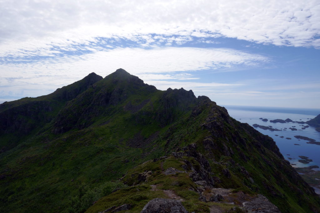
I have read and heard about the natural beauty of Lofoten in the north of Norway. Beautiful scenery and quaint fishing villages as well as a beautiful road snaking itself between the islands of Lofoten over bridges and trough tunnels.


Read More

Lofoten

I have read and heard about the natural beauty of Lofoten in the north of Norway. Beautiful scenery and quaint fishing villages as well as a beautiful road snaking itself between the islands of Lofoten over bridges and trough tunnels.

I am currently residing in the Γ…re vicinity in Sweden. I packed my Yamaha Tenere 700 with clothes and stuff such as tent, sleeping bag and air mattress, I only plan to use these in an emergency where I can’t find any accommodation. The distance to the ferry to Lofoten is around 700km so after some trepidation I set off.

I decided I could not go the whole way to Lofoten in one day so the first day I would go to MosjΓΆen, a distance of around 400km.

The first 55 kms goes through Sweden via Skalstugan on a nice flowing and twisty road with beautiful views over the nearby mountains, before going into Norway through a narrow valley towards the Trondheim Fjord. On the Norwegian side I stopped at a narrow bridge crossing the river and walked across. It turns out this path leads to defense fortifications that were built to defend against the Swedes in 1905 at the Sweden-Norway union dissolution. It’s a convoluted history going back to 1814 when Norway came into a union with Sweden after Denmark was forced to “give” Norway to Sweden as a result of Denmark being on the loosing side in the Napoleonic wars. Before 1814 Norway had been a part of Denmark for hundreds of years. In 1905 the Norwegian “storting” (parliament) decided to dissolve the union with Sweden and Sweden did not fight the issue and Norway became an independent country. 

As I get closer to the fjord the landscape opens up and there are a lot of green fields and smell of farm as I ride past farm houses – nice! Once down by sea level the road connects to the E6 and I turn north. The E6 is the north-south artery of Norway, stretching through the country from the Swedish border in the south to the Russian border in the far north east, with a total length through the country of 2628km! I pass through the town of Steinkjer and a bit further north I stop at a pretty rest-place for lunch. I had packed some sandwiches and filled a bottle of water that work nicely to fill me up for the rest of the day.

As I’m having my lunch I strike up a conversation with a German biker and it turns out he is also going to Lofoten and that is as far north he is going.

Lunch by the E6

I continue to MosjΓΆen and reach the town around 5 pm. I have booked a room in a dog pension that got good reviews and was reasonably priced. I hadn’t checked the location of the pension carefully and it turns out it is 25km from the town. The road to the accommodation is taking me along the main road to SandnessjΓΆen along the north side of a fjord and I turn off up towards a hill along a gravel road and as I turn in to the property I see 4 other bikes parked along the building and I know I’m at the right place. Later on there are a few rooms taken by people with dogs but the dogs are well behaved and not allowed in the common rooms.

Motorcycle pension

I find in general there are a lot of bikers on the roads in Norway. Adventure biking has really taken off big time and a lot of the bikes are BMW GS models. Kudos to BMW for making a good bike and marketing it well.

The following day I get away at 9 am and am soon back on the E6, after a while I stop when I see a sign for sight seeing. The site in question is of two old vault bridges built of local rocks in 1926, beautifully built with a wild stream running beneath. These were the last bridges built with this method in Norway, later bridges were built using concrete and/or steel. The views over the fjord and mountain are breathtaking and I can’t get enough of the view.

Waulted bridge

Fjord views

The first town I hit is Mo i Rana where I stop for petrol and some chain TLC, as I’m doing this, a group of motorcycles arrive and I start talking with a biker, they are all from Vietnam and has joined a tour that provides bikes and a guide and are on their way to Nordkapp. Interesting!

I’m soon on my way and after a while I arrive at the polar-circle center located (yeah, you guessed it!) on the polar circle. I meet the German biker I met at lunch the previous day and we decide to ride together towards Lofoten.

Polar circle

Bikes at polar circle

As we go further north we go on the south side of the Skjerstad fjord instead of the faster north side via Fauske. The south side road is more motorcycle friendly with twisty mountainous passes and not much traffic, it turns out there are a lot of sheep on the road as well making for an interesting passage.

Sheep

At the end we get on “riksvei 17”, the scenic road from Steinkjer to BodΓΆ, and we pass a magnificent bridge over Saltstraumen. Saltstraumen is the narrow inlet to the fjord and as the tidal state changes there are very strong currents, hence the name, “straum” means current in Norwegian.

Saltstraumen bridge

We decide to try and reach the next ferry from BodΓΆ to Moskenes on Lofoten. We reach the port 15 minutes before the ferry is sailing and after paying the ticket we are waved onboard.

Leaving BodΓΆ behind

We’re concerned it might be challenging to find accommodation on Lofoten, it being a very popular tourist destination in the summer. Michael, my German biker friend, gets on the phone and finds accomodation around 70 km from the ferry port. It seems like quite a long way but the landlady assures us that it won’t be a problem, we should take it slowly and admire the views as we go along.

As we get closer to Lofoten and view the jagged coast-line and mountains for the first time, I can feel the anticipation growing, there are a lot of people standing with views of the islands and I can almost hear their gasps at the amazing views!

First views of Lofoten

The ferry ride is between 3 and 4 hours so we have time for food and a nap before arriving in Moskenes. We don’t go directly towards the accomodation but go the other way to a place with the short and sweet name “Γ…” which is close to as far south you can go on Lofoten.

View from Γ…

View from Γ…

We turn north and start our trek to our accomodation, Anne Gerd’s guesthouse. We pass through quaint fishing villages, narrow single lane bridges and tunnels as the road winds it’s way across the islands.

Fishing village

It takes a couple of hours with all the stops for photo opportunities, but we finally reach Anne Gerd’s guest house around 9 pm. It’s been a long day and I’m pretty knackered so after a quick shower I hit the sack. The day’s route:

The following day, after a good night’s sleep, Anne Gerd, the landlady, insists that we hike up to higher ground to get the postcard view of Lofoten. With her convincing we decide to stay another day and Anne Gerd drives us to the trail head where she declares the hike to be an easy one. It turns out it’s not so easy, very rocky and steep, but we manage to hike up to an altitude of 350 meters. On the way we pass a ski lift with an adjacent alpine hill with light-posts, it starts at sea-level and ends at around 350 m above sea-level so quite a nice steep hill. Later I hear that it’s not every year there is enough snow for skiing. We continue to go higher and we must admit our landlady was right – the views are really quite amazing!

Stamsund hill towards Sennesvik

Stamsund hill towards north-west

 Stamsund hill towards Stamsund

Stamsund hill towards south

In the evening we rode to a small quay side restaurant in the Sennesvik village. We were told the whale beef was so tender it was like biting into butter, Ok – it wasn’t that tender but very nice!

Whale meat for dinner

The day after the hike we start the trip back south, the weather is not so nice with light rain, fog, temperature around 10C and wet roads.

Gloomy start of the return trip

Single lane bridge to Hennigsvaer

We first stop to explore the Hennigsvaer football pitch shoehorned in between cliffs on a small island. And it’s not a cheap installation with artificial grass. Quite amazing!

Hennigsvaer

Hennigsvaer football pitch

The plan is to take the ferry from LΓΆdingen to Bogenes on the main land and take the E6 south. The ride to the ferry goes without problems and we literally reach the ferry just as it is about to leave. As we board the bow visor is shut and the propellers start to spin. It is a short ferry ride and we’re soon on the mainland and ride south and as we reach Fauske we stop for the night.

Anne Gerd’s to Fauske

We stay the night in a motel at LundhΓΆgda camping, it is a small room but with shower and toilet and a comfortable bed – who needs more? I wake up early next morning and have some leftover pizza from previous night’s dinner for breakfast before we set off south. My plan is to get “home” doing close to 700 km. At the junction of E6 and the road to Sweden in Verdal, Michael carries on a bit further while I do the last 100 km to reach Γ…re…

Last day trip

Home Sweet home

Duved to Skalstugan and back via FrΓΆΓ₯ old mine

I made a day ride to Skalstugan close to the Norwegian border and then returned via FrΓΆΓ₯ gruva, an old copper mine, mined 2-300 years ago, where I had a very nice lunch and then back to Duved. 

Starting off from home in beautiful Swedish summerweather with temperatures in the mid 20s Centigrade.

The ride to Skalstugan offers a beautiful, winding, asphalt road, perfect for a motorcycle! The views with lakes and mountaineous terrain is fantastic! 

Google map of the Skalstugan roundtrip ride.

Beautiful views over lake Klingerselet.

Paved road with nice sweepers, perfect for a motorcycle

Skalstugan, the main goal of the trip.

After crossing into Norway and turning towards east rather than going straight north to Verdal the road follows the border for several kilometers before turning into Sweden again.

As soon as the road turned back to Sweden it became a gravel road

Swedish gravel roads typically have 3 fields of loose gravel with 2 fields of bare compacted gravel on either side of the center gravel strip, pretty natural, I guess? So to get more feeling for “proper gravel roads” I stayed in the loose gravel a lot of the time. It takes a while to get used to the front sort of floating and not having the planted feeling of asphalt.

Stopped in the middle of nowhere , curious why there were several cars parked there.

Forest stream…

After 20 kms after crossing into Sweden I reached Anjan which is both a place and lake. It’s got a “fjΓ€llstation” which is like a hostel where you can stay the night or get some food. Anjan is a great place to start your hikes on foot in the summer and on skis in the winter.

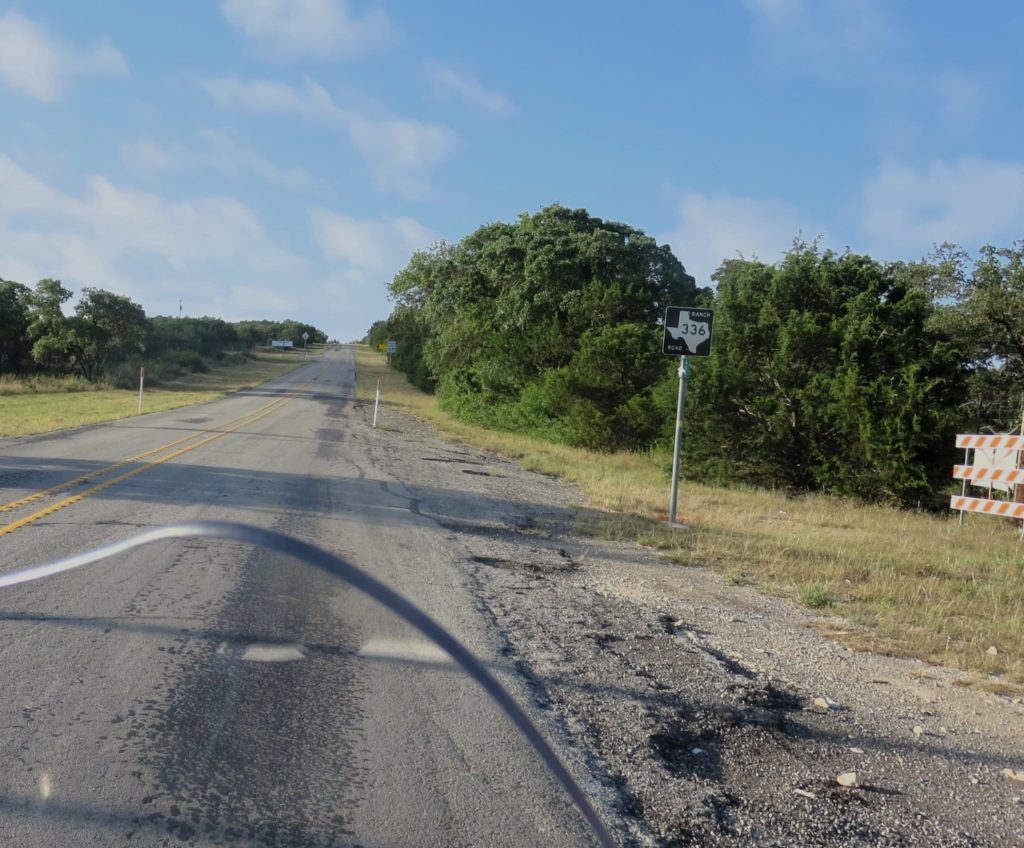
I followed road 336 for a further while and then turned right on to a road that runs on the western side of KallsjΓΆn, this road is even smaller than the eastern side road and not so well prepared, making it a lot bumpier with several ascends and descents of hills. Some beautifull views of KallsjΓΆn along the way.

Views from the western side of Ka.llsjΓΆn

After passing through HusΓ₯ I turned off on a road towards FrΓΆΓ₯ gruva which climbs the hill on the eastern side of Γ…reskutan with some nice views of the mountain that I typically never see. After 10 kms I reached FrΓΆΓ₯ mine and the restaurent was open so I had a very nice lunch.

FrΓΆΓ₯n restaurant.

Lunch in beautiful weather with gorgeous views

Copper was found by a seamstress, Anna Larsdotter, in 1744 at FrΓΆΓ₯, and copper mining was started soon after. Mining was hard work bringing the rocks to the surface and removing the water in the deep hole and, first, horses were used for the work, and after a while power was transferred from a stream one kilometer away using a primitive system of wooden beams.

After a nice roast beef followed by coffee and reading up on the history of the mine, I carried on, on the gravel road, first passing BjΓΆrnrike, a newish area for tourists wishing to ski in, perhaps, more family friendly slopes than the slopes in Γ…re, and then on to the main road connecting Γ–stersund with Γ…re and continuing west through Γ…re to get back.

A beautiful ride on roads that I’ve never been to before!

Western USA 4600 mile roundtrip

I found a blog on the internet by a group who did a round trip in the western USA   with a route that  includes many interesting and scenic places. This inspired me to plan for and make my first long trip on the motorcycle in the USA. 

July 1 2016. Missouri City to Lubbock 520 miles

The route today will take me to Texas 36 which takes me up to Abilene, then along I-20 and finally on US-84 to Lubbock.  Texas is a big state and the first day will be a long ride. 

The wife and baby got up early to see me off and then I was on my way.

I stopped for a water break at Comanche. When I was a kid you knew about some of the different Indian tribes from TV wild-west shows and the  Comanche tribe was one of them. So quite special to stop here for a short while to refuel the body.  It’s July in Texas so the temperature is bound to get high and today is no exception.

After lunch in Abilene I made it to Lubbock around 5pm, so the first day is completed!  It was pretty hard work with temperatures reaching 36C (97F).  Also, the scenery in the parts of Texas I traveled through is not the most interesting…  On the road from Abilene there are many wind-turbines as well as donkey-head oil pumps so wind above ground and oil below ground. 

I had dinner at an Appleby’s close to the hotel. After a nice chicken meal with a Margarita I felt much better but still wondering what I had got myself into. Maybe, I was dehydrated after the long ride, but I didn’t really feel too optimistic about spending another 16 days away from home on my own.

Lubbock to Fort Sumner 273 miles

Early morning setting off after some freshly made waffles with coffee. I slept from 2030 to close to 0600, soo tired after the first day of riding. Well, today was not nearly as far as the first day and with some nice scenery along the way so should be pretty good.

The map shows I will first be traveling north to Palo Duro Canyon state park on I27 and then on to US60 which I will be on for the next few days.


Hotel manager.

The Palo Duro canyon Texas state park is the 2nd biggest canyon in the US, of course, after the Grand Canyon! It’s located in the Texas pan-handle and close to Amarillo.  After an early morning easy ride north from Lubbock on I-27 I entered the park.  It clearly is a huge canyon 120 miles long and 5-6 miles wide with an average depth of 250m.  There is a road from the top leading down to the base and I rode along this.  I was getting low on fuel and didn’t want to risk running out so I turned back before getting to the end.


Fort Sumner

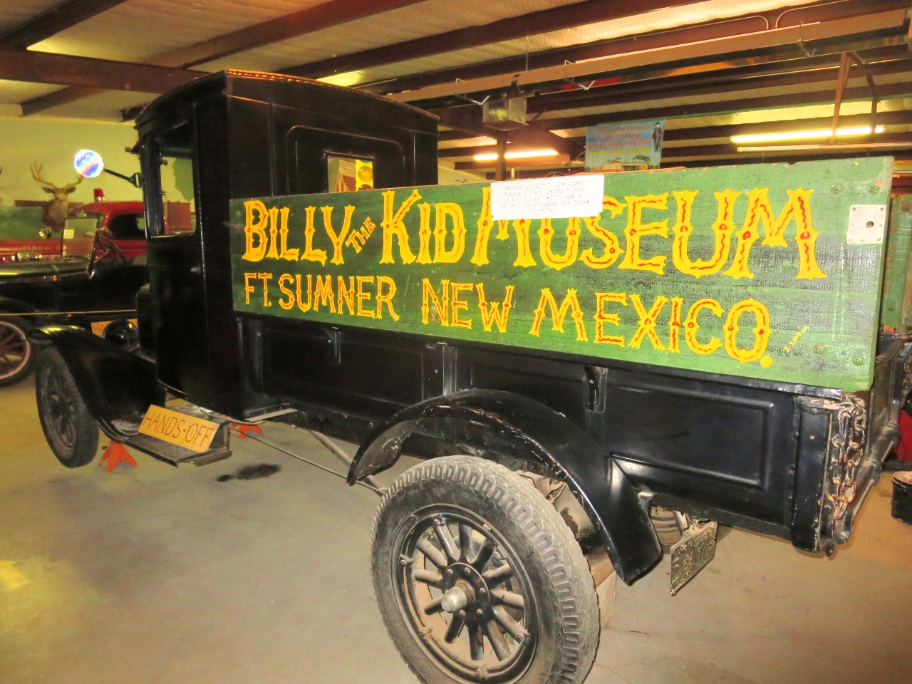
After refueling I set off along US 60 towards the west and Fort Sumner.  It’s a straight dual carriage highway and with few cars which made for easy but not very exciting riding and I reached the town early afternoon.  Fort Sumner is pretty bleak place in the middle of nowhere. However, it’s the town where Billy the Kid is buried. So, of course, there is a museum to celebrate the outlaw.   So I went to the museum – right next door to the motel, and learnt a bit more about the kid. He was only 21 when he died and, maybe, he wasn’t all bad.  His father died when he was young and his mother when he was 15 and he started his criminal career soon after.  After 6 years of criminal activities he was captured by sheriff Pat Garret and was sentenced to be hanged.  He escaped and came to Fort Sumner where he was found and shot by Sheriff Garret.

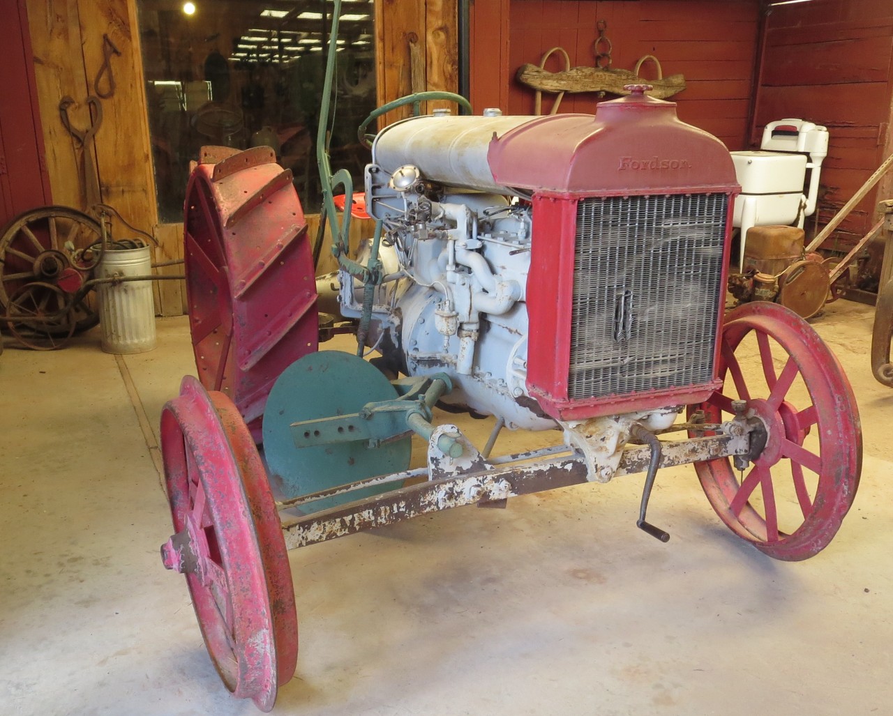
There was also a collection of old cars, tractors and wagons  in the museum so and I snapped some pics of them.

Later on I went to the burial site of the kid a few miles from the town.

I thought I’d find a local restaurant for dinner but couldn’t find anything open so luckily I found a supermarket and bought a microwave dinner. It wasn’t fantastic but eatable…

Well kept or restored 1950’s car. No idea which make or model.


Billy the kid with his gun.

July 3,  Fort Sumner to Springerville – 342 miles


I got away early at 0630 , a nice and cool start of the day!  Beautiful weather, hardly a cloud in the sky so should be another fantastic day in the saddle!

Stopped here for first break of the day. You could clearly see people had used the plaque for target shooting so it was now unreadable…


Later on I stopped to admire the Karl G. Jansky Very Large Array (VLA) which is a radio astronomy observatory located on the Plains of San Agustin, between the towns of Magdalena and Datil, some 50β€―miles (80β€―km) west of Socorro, New Mexico. It comprises 27 25-meter radio telescopes in a Y-shaped array and all the equipment, instrumentation, and computing power to function as an interferometer.  Each of the massive telescopes is mounted on double parallel railroad tracks, so the radius and density of the array can be transformed to focus on particular bands of wavelength.  Astronomers using the VLA have made key observations of black holes and discovered magnetic filaments and traced complex gas motions at the Milky Way’s center, probed the Universe’s cosmological parameters, and provided new knowledge about the physical mechanisms that produce radio emission. 

It is also the setting for scenes in Contact, a 1997 science fiction movie starring Jodi Foster and Matthew McConaughey.


Vaughn, New Mexico.

Before hitting Pie Town I passed by the continental divide so waterways further west will drain into the Pacific.

Pie Town

The name comes from an early bakery that specialized in dried-apple pies and was established in the early 1920s. It is to this day the location of several establishments serving mouth wateringly new baked pies.  Of course, I had to have one with a dollop of ice-cream.   Very delicious!


Springerville

I stopped here for the day after  330 miles today in pleasant temperatures. The town is called Springerville which is located at an altitude of 2100m and I found a room at Reeds lodge, a rustic kinda place.  Because of the 4th of July holidays and the proximity to Phoenix  and Tucson, it was not easy to find a room so I had to settle for a smoking room πŸ™  however,  they ran an ionizer to reduce the smell of smoke and it worked pretty well.

I had dinner at a restaurant which John Wayne with his ranch hands used to frequent in the 60’s. Apparently he owned several ranches in the area.

After the in room chicken microwave yesterday today’s rib-eye tasted exceptionally well. The waitress poured me a very generous glass of red wine so dinner was very good.

Since Arizona decided not to have daylight savings I’m now two hours behind Texas time.

Springerville is at such a high altitude that the temperature is much lower than in the big cities of Tucson and Phoenix and consequently people of those cities low to come here to cool down, that’s why it’s difficult to find a room, especially at extended weekends such as the 4th of July.

Reeds lodge interior.

Very traditional looking diner in Springerville.

Missouri CIty - Lubbock - Fort Sumner to Springerville.

Missouri CIty – Lubbock – Fort Sumner to Springerville

Springerville to Payson 231 miles

Had a very early start at 0600 and rode to Ft Apache. The road crossed some high hills and at one stage the elevation was more than 2700m and with a temperature of 10C it felt rather cold.

After an hour or so the road was descending and had some very nice sweeping turns and in the middle of a turn I met a police car, in the mirror I saw him quickly turning around and putting his lights and sirens on and I knew he was coming after me!  I stopped before he caught me up in a parking space along the road and sure enough he stopped right behind me.  After coming out of his Ford explorer the cop said I was doing 75 in a 55 zone.   He turned out to be a nice chap and after checking license and insurance he lowered my speed to less than 65mph and gave me a ticket for wasting energy by going to fast! But no points on my license… He was a great guy and we then had a chat about the area which turned out to be Indian land.  So, not fun with a ticket but it could have been a lot worse πŸ™‚

After this I rode a bit slower and soon reached Fort Apache.  This used to be a military fort and played an important part in the indian wars in the late 19th century but was converted into a Bureau of Indian Affairs boarding school after its military use ended.  I spent a bit of time here trying to picture in my mind indian wars from the many Wild West movies I’ve seen.

Not far from Fort Apache I stopped at the Kinishba ruins.  Estimates suggest the buildings were built and occupied from the 12th to 14th centuries as part of the ancient population boom within the Mogollon Rim region and beyond. Centralized in the lush mountains of the Mt. Baldy watershed, the area has been linked to both Mogollon and Anazazi cultures. They were considered part of the western Pueblo complex.

There you go, the benefit of having Wikipedia handy!

Tonto national monument

The Tonto National Monument provides a place to explore and learn about a unique part of America’s heritage.  Wikipedia states; “The Salado Phenomena, 700 years ago, blended ideas of neighboring Native American cultures to emerge a unique and vibrant society. Tonto National Monument showcases two Salado-style cliff dwellings. Colorful pottery, woven cotton cloth, and other artifacts tell a story of people living and using resources from the northern Sonoran Desert from 1250 to 1450 CE. ”

To see the cave dwellings required a steep walk and in the 38C temperature I decided I would be happy with a photograph!


It’s a beautiful area with desert like terrain meeting a lake, very picturesque!


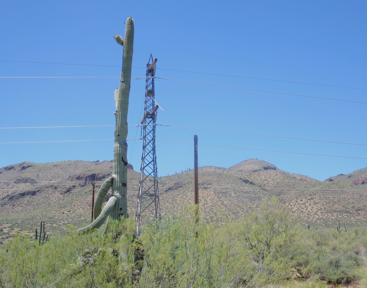
I saw the cactus in the picture along the road, it’s absolutely enormous! It’s a tree looking cactus called the Saguaro and it can grow to 12m height and 150-200 years age!  Amazing!

Payson Arizona

I reached Payson late afternoon and checked in to Quality Inn.

The day started with cool temperature of 15C going down to 10C at the summit of 2700m. The trip then gradually came down to lower elevations with increasing temperatures and the reading on the bike showed 40C for some time.

The roads where the best so far on the trip for a bike, quite a few twisties, mainly sweepers but also some sharp corners when riding across the Salt River Canyon which also had some spectacular views, see photos.

Being caught for speeding put a damper on the day but the cop was nice and the fine only $67.50 with no points on the licence, so could have been a lot worse. However, going at 55mph on a good road is not much fun on a motorcycle, particularly if there are some nice long sweepers:-( I was going to ask the cop if I could take a photo of him but thought it might not be apropriate. It seems speed limits in New Mexico and Arizona are lower in general than Texas. I was riding on a minor road leading to the Duro Canyon and the speed-limit was 75mph! OK, that actually seemed too fast for the fairly narrow road…

The Quality inn hotel was very nice with a huge room and s small pool. Had Mexican Fajitas for dinner – also pretty tasty.

Payson to Cameron 236 miles

Today’s route should be exciting going along US 89A to Jerome which is a twisty road going up and down a mountainous area then to the beautiful area at Sedona before going on towards Flagstaff and then west of Grand Canyon to the Cameron trading post.

Stopped for breakfast at Starbucks, lattΓ© and an almond croissant. Enjoyed some wonderful riding this morning along US 87 and Arizona 260. A lot of flowing sweepers and no cars!


Stopped in Jerome, an old mining town after first riding along 89a, amazing road with supposedly 127 turns! Almost as good as Stelvio – or maybe not, but very nice.  Jerome used to mine copper until the 1950s. In the 20s it had a population of 15000 but after the copper boom was over the population dwindled to some 50 people in the late 50s! Stopped in the bar for a drink.

Stopped for a long time for road works.


Interesting bar in Jerome.

Red rock formations around Sedona.

Red rock formations around Sedona.

Stopped to admire the vie at Oak Creek Canyon scenic overlook. I just came up that road - very nice!

Stopped to admire the view at Oak Creek Canyon scenic overlook. I just came up that road – very nice!


Cameron Trading post.  West of Grand Canyon

Checked in at Cameron trading post. Seems like a really nice place in the middle of nowhere. The good thing is that it’s only 30 miles east of Grand Canyon. Today saw some great scenery and some great riding. I started early at 0630 on Arizona 260 with many great sweepers and very few cars. The road came up as high as 2100m and then down to 1200m where it joined I-27. After a few miles south on I-27 Arizona 169 led to US89A that went up the pass and then down again to Jerome. It supposedly has 127 turns during a 12 mile stretch. I stopped in Jerome for some refreshments and enjoing the old copper mining town. I then came back on US89A towards Flagstaff and passed through Sedona in the red rock country, very beautiful and dramatic red rock formations. The road followed Oak creek and again climbed through many turns up the side of the creek before eventually leading to Flagstaff. I did not stop there but went straight on to Cameron. The last bit of the road was straight but heavy cross-winds made the riding somewhat hard work. Cameron is in Navajo reservation land and most of the staff at the trading post appear to be Indians. Interesting. I’m staying here for two nights with a round trip to Grand Canyon tomorrow. I’m really looking forward to seeing the magnificent natural wonder again, it’s the third time I see it but it’s something you can come back to again and again.


Grand Canyon

I reached Grand Canyon by 0700 and got the beautiful morning light and a nice cool breeze welcoming me. Coming in from the east there are many vistas where to admire the view with the first one being desert view where there’s also a tower built in an old style. The views are breathtaking but as you go along to see more and more different views you do, perhaps, get saturated?  It’s difficult to find a place to have breakfast but finally I found a place. It’s funny – I can see 3 blocks with restrooms but nowhere to eat – what’s the logic in that?

Walked 4 km along the rim to the El Tovar hotel digesting the overwhelming views as I walked along. Will such experiences change your outlook on life? Haha, that’s too deep for me to answer.   After another coffee in the hotel I’ll walk to the Bright Angel trail head, the name comes from a cambrian shale which is part of the Grand Canyon section.  I did walk to the trail and walked down it for 10 minutes or so and then back up. I was afraid to use too much energy since I had to ride back to the hotel in Cameron which turned out to be 50 miles. Or, maybe I was just lazy?  I now felt I’d had enough of GC after spending 6 hours there and decided to go back to the hotel in Cameron.

July 7, 2016.  Cameron trading post to Panguitch 230 miles

Standing on the old bridge crossing the Colorado river 100m below. Beautiful bridge and amazing scenery. I got up at 0530 , as usual, and had a proper breakfast before setting off going north on us 89 and then turning on to 89A – this is the road that you take to get to the Grand Canyon north rim. This is the first stop of the day. Being early and high altitude the temperature was in the mid 20C. A very pleasant morning.
 

The Colorado river looks really serene and still. Nevertheless, the power of the river as it flows on the soft rocks formed Grand Canyon over the millenia.

The Colorado river looks really serene and still. Nevertheless, the power of the river as it flows on the soft rocks formed Grand Canyon over the millenia.


Bryce Canyon

Yet another canyon but very different from Grand Canyon. Beautiful orange sandstone that’s eroded to create figure like formations. This place is just incredible! I walked along the rim and went down some way on the Navajo trail, quite a descent (in my mc gear!).


Panguitch

Checked in to Day’s Inn – room seems ok. I went to the post office to get some stamps and hoped to find a bar where I could write some postcards. Turns out there are no bars, not sure if that’s because of Mormon rules? Anyway, a local told me I could get a beer at the chevron station and it turned out the smallest single bottle they had was a pint size can! So much for keeping people sober!
 
It seems several towns are proud of the outlaws that used to live there or even visited at one time or another.  Panguitch claims that Butch Cassidy at least visited the town and celebrates this with big photos and plaques.  I had dinner at what purported to be a Tandoori place, however, it was more of a mixture of Indian and Mexican food, not nearly as good as our Indian place in Sugarland… Nevertheless, I talked to the proprietor for a while and found out that her father in law works for Statoil in Houston as a geologist! After dinner I walked back to the hotel through the back street in an almost cool temperature. The town’s at 2000m altitude so in the evening the temperature drops.  In fact, I’ve been pretty lucky with the weather so far on this trip. The last few days the temperature has not hit 30C.


Salt Lake City is famous the world over for being the center of the Mormon church and it was a must visit place on this trip.  I’m now in Utah and will be traveling through the state for the next 2-3 days.  Along the road I see many beautiful church-like buildings were no expense was spared in their construction.  I reached Salt Lake around noon time and found motorcycle parking spaces close to the center of town.  After surveying the area I set about looking at the Temple Square which was the original area set aside for the Mormons in the 1840s.  The Tabernacle is a rather unusual building that has been praised as an architectural wonder but has also received negative reviews as being ugly and dreadful.  For it’s time the roof span of 150×450 ft with no supporting pillars was ahead of it’s time when it was finished in 1867.


Mormon Tabernacle.

Mormon Tabernacle.

Salt Lake Mormon Temple

Salt Lake Mormon Temple

After lunch in the Nauvoo Cafe housed in the Joseph Smith Memorial building I rode north towards Ogden and the hotel I had booked for the night.  However, I got somewhat lost and decided to carry on until the first decent motel along the way. So I ended up in a Comfort Inn outside of the town Logan, if only I had known that in the town itself there were lots of accommodation and then I wouldn’t have had to ride the bike to get to a restaurant. Oh well, no big deal.

Today was not so exciting, I suppose the previous 3-4 days have set my expectations too high. Salt Lake was nice but not hugely so:=( I also felt a bit tired. I hope a good night’s sleep will get me off to a good start tomorrow for the ride to Jackson Wyoming. So far I’ve been in Texas, New Mexico, Arizona and Utah. Tomorrow I’ll briefly touch Idaho before going into Wyoming.

A note about time zones which is kind of confusing. New Mexico and Arizona are in the mountain time zone. However, Arizona decided not to go with daylight saving so they’re 2 hours behind Texas. To complicate matters the Native American reservations decided to go with daylight savings. Utah is on mountain time with daylight savings…

Logan to Jackson Hole Wyoming – 193 miles

Jackson Hole is known for it’s wintertime skiing but it’s also busy during the summer so I needed to get there early to secure lodging for the night.  After the usual motel breakfast of hot waffles and weak coffee I got going but I missed the turnoff to the west along US 89 and ended up going along US 91 instead which was due north.  It took me some time to figure out I was going the wrong way but when I did I found that road 36 would take me back on the 89 and what a delight the road turned out to be!  It went up a mountain pass to 2200m and then down again along twists and contortions making for a beautiful ride on a my Trophy.

Back on 89 I stopped in the town called Afton for a coffee.  It boasts  it has the largest elk antler arch in the world spanning 4 lanes across the US 89 with 3000 antlers used in its construction and weighing in at 15 tonnes.  BTW… “Afton” is a funny name for a swede, in swedish it means evening!

Jackson Hole

Once I arrived in Jackson I managed to get a room at motel 6 at an outrageous price. I changed into “civilian” gear and taking the bus to the center of town for some relaxation.   It’s Saturday and a busy day with lots of tourists walking around not doing much apart from being touristy.   There are four entrances to the Town Square and there are basking musicians in front of three of them.  They must have shot a lot of elk in Wisconsin since there are so many arches built by elk antlers!  Very nice though, it must be a lot of work getting them all in place, I wonder if they glue the pieces together? 
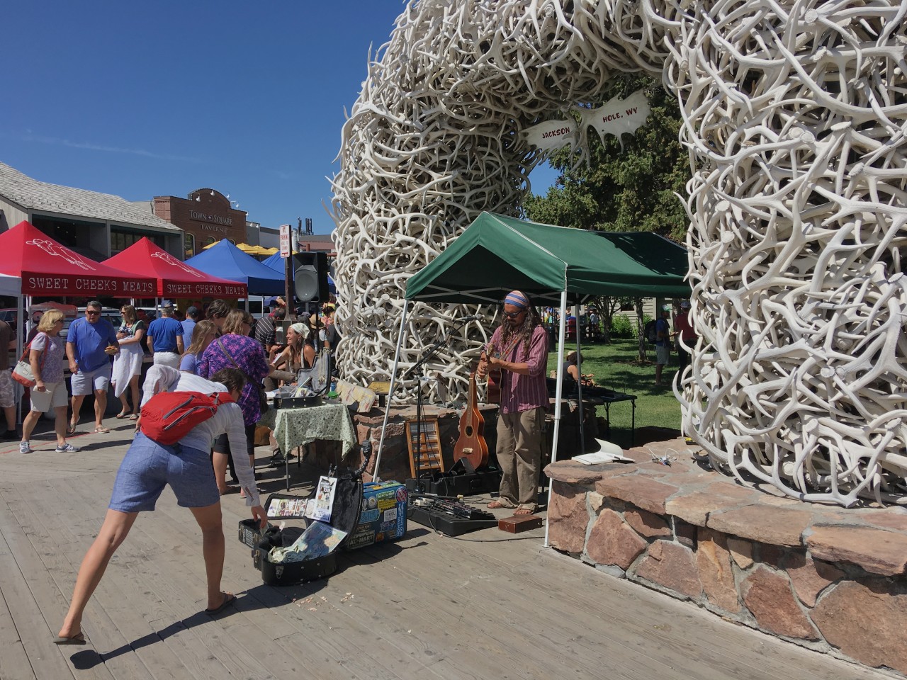
The famed elk antler arches that lead into the town's lovely, tree-shaded Town Square where locals and visitors come to relax or enjoy special events.

The famed elk antler arches that lead into the town’s lovely, tree-shaded Town Square where locals and visitors come to relax or enjoy special events.


Riding police keeps the order in town and attracts attention from visitors.

Riding police keeps the order in town and attracts attention from visitors.

Great ski slope close to center of Jackson Hole.

Great ski slope close to center of Jackson Hole.

The Jackson ski slope is very close to the center of town and it seems like a good slope.   I saw that the lift was going so I strolled down to it and asked the lift guy, he said its 479m elevation change which is really good.  I’m sure the skiing there is fantastic!  It’s also lit in the winter meaning you can ski to late evening.

Cameron, AZ to Jackson Hole, WY

Cameron, AZ to Jackson Hole, WY

Jackson Hole through Yellowstone National Park to Gardiner, Montana – 190 miles

It’s cold when I start and I wish I had heated grips on the bike.  The weather is clear when and I get really good views of the Tetons just to the west of me.  I stop at the, apparently, most photographed barn in the US to get some photos of the mountains with the barn in the foreground.  The sky is darkening to the north and not boding well for my passing through the Yellowstone National Park. 


As I pass by Jackson lake the sky is looking really dark and it starts to rain and as I get to the Yellowstone entrance the rain turns into hail and it gets really cold.  I stop to put on the cold weather gear I brought, which is not enough, when I set off from home I had no idea that it would get this cold.  With the rain gear on I start the trip through Yellowstone, brr.  After a couple of hours in these conditions I finally reached Ye old faithful Inn and stop for breakfast and to warm and dry up.  Food is really nice and I start to thaw up pretty well.
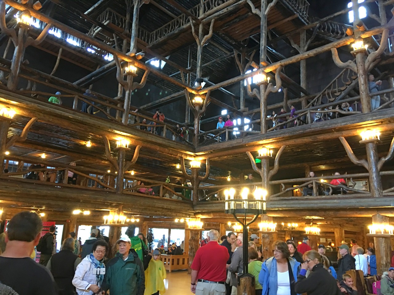
Ye old faithful hotel.

Ye old faithful hotel.

s


Gardiner

It was a relief to arrive at the “Yellowstone River Motel” in Gardiner. The day started out beautifully with grand views of the Grand Teton mountains but just as I was entering Yellowstone national park it started hailing and with the low temperature of 7C I felt pretty miserable on the motorcycle ????.

With the road being white in places from the hail I tiptoed my way, very afraid of slipping. My hands were getting numb from the wetness and the cold plus me being tense… This does not make for very pleasurable riding and you also loose the feeling for the road when you need it most on wet and pretty rough asphalt roads. But I managed to get to Old Faithful Inn to warm up and as I was having breakfast the rain stopped.

Gardiner is located right at the northern entrance to Yellowstone and is a small town living off people stopping by before entering the park I presume. Not sure what they do in the winter with so many fewer tourists?

I found a laundromat and washed my clothes, good, that means I don’t need to wash em by hand????

There’s a grill place so I had a nice rib-eye washed down with a glass of Malbec which got me in a really good mood.

The river in the picture is the Yellowstone river and is just to the back of the door to my room.

July 11, 2016 Gardiner to Gillette (400 miles)

Today is a pure transport day and there are not a lot of sights along the way.  I stopped for lunch at a McDonald’s close to the town of Sheridan. I was sharing the table with a local guy and had to listen to him talking incessantly about his family history and how he spent 35k on his research including dna tests. Yawn yawn????. Of course, he also told me the country would be safer if people had more guns and/or fierce dogs to keep the bad guys away. He was voting for Trump, he also told me ???????? If nothing else it gave me company and some entertainment for lunch.

Gillette

Checked in to Day’s Inn Gillette Wyoming after a 400 mile ride today. Most of the ride was in light rain with strong cross-winds and a temperature around 11C making for a somewhat hard ride. The last couple of hours, after lunch, the weather got better with no rain and 20C allowing me to take the rain gear off.

The speed limits in Montana and and Wyoming are at 80 and 75mph so I could make fairly rapid progress. With the strong cross-winds it was dodgy going even that fast. With water on the road the big trucks create an enormous amount of wet mist and when passing them it’s like going into a fountain of mist with very limited visibility.

I met a guy on an old Ducati Monster at a rest stop who was on his way from Seattle to Mount Rushmore. With little protection from the elements and cramped riding position  on that bike he must have suffered. He was also camping… Well, he was young.

Tomorrow I’m first going to Devils tower which is an laccolithic butte composed of igneous rock in the Bear Lodge Mountains near Hulett and Sundance in Crook County, northeastern Wyoming. It looks quite spectacular on the pictures I’ve seen.

If I get up early and the weather is cooperating I should be able to see Mount Rushmore tomorrow as well.

Gillette, WY, to Keystone,SD,  taking in Devil’s tower and Mount Rushmore

Devil’s tower

This is an amazing natural “monument”. I’m walking the trail around the tower among Ponderosa pines and I’m here early so hardly any people. An incredibly peaceful experience in awe of what nature can accomplish.

Steven Spielberg fans are likely familiar with Devils Tower, even if they don’t know it by name. The dramatic butteβ€”which towers 1267 feet above the plains of northeastern Wyoming and the Belle Fourche Riverβ€”was famously featured in 1977’s Close Encounters of the Third Kind, culminating in a scene in which an alien mothership descended upon the rock formation.  Interestingly, it was also the first national monument in the US.

After a couple of hours at Devil’s tower I continued towards Mont Rushmore and stopped by the Pactola Dam on 385. As I was admiring the views a motorcycle trike (3 wheels) stopped at the same place.  It was towing a dog trailer with 2 dogs in it! I had a chat with the owners and one of the dogs was not so happy being in the trailer. I can imagine the trailer sways quite a lot so I’m not surprised the dog wasn’t happy.

The guy told me he broke his foot last autumn and his doctor advised him not to go two up on the bike anymore so he converted his bike to a trike and so far he was very happy with the result.

Ok, finally made it to Mount Rushmore. Ever since I saw Hitchkock’s North by Northwest (one of my favorite movies) I wanted to see the monument. And finally here I am! I’m not sure I’m as impressed as I thought I would be, but the scale of the Monument is amazing. I walked the presidents trail that takes you much closer to the carvings and you can get some good close ups of the faces with a zoom camera. So who are the presidents? Well, from the left its George Washington, Thomas Jefferson, Teddy Roosevelt and Abraham Lincoln. I guess all Americans know this from an early age? Constructed between 1927 and 1941 it was not completed to its original design but the work stopped due to lack of funding. It seems they did not need to complete it – there are two million visitors every year!

Mount Rushmore


Keystone


Keystone to Salina (610 miles)

Salina, KS

Checked in at Days Inn. Supposedly I’ll get a free night now that I stayed more than two nights but they probably make it so complicated that it’s not worth the effort?

Did 620 miles today and still feel pretty good. Guess mind and body is more used to sitting on a bike for about 9 hours..

The day started out pretty cold at 10C but gradually warmed up as I got further south and lower elevation to end up at 34C. Mainly going on non-interstates and single carriageway, but they are in good condition with little traffic so my average speed today was 68 mph (if you believe the statistics produced by the bike).

Today I’ve ridden through South Dakota, Nebraska and now Kansas. Seems like they are all big farming states – riding past huge fields of cereal and corn. They’re harvesting the cereal fields with huge combine harvesters as I ride past.

I had a salad dinner at the nearby Mexican restaurant, it was nice with a cold beer after today’s time in the saddle! When on your own it’s nice to sit at the bar where you can chat to the bar staff and other people seated there. I talked to the bar girl and she said you pronounce Salina as it rimes with “saliva”. Strange pronunciation…

Tomorrow towards Oklahoma City, Dallas and possibly Houston… Home trip going quicker than I originally thought.

July 15, 2016 – Salina to Houston (719 miles)

Stopped at a scenic outlook and came across a wing for a wind turbine. It looked massive but the guys transporting it said it was a baby, maybe around 40m. The biggest ones in Europe are 85 m long they told me.

Paoli, OK


At the same spot there was a stone commemorating the birth of reflection seismic! J Karcher did the first experiments in the area in 1921. What a coincidence! I’ve spent my entire career on reflection seismic and haphazardly coming across this memorial stone is quite amazing!
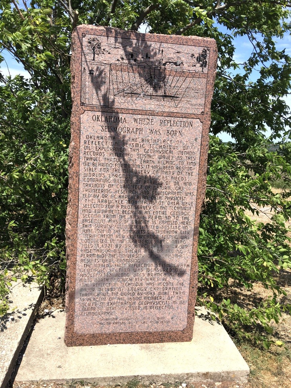
Riesel, TX

More fuel and some junk food. Only 180 or so miles to home…its been very hot with temperatures as high as 40c. Coming through Fort Worth was a big pain with a lot of road construction and it felt very uncomfortable going very slowly as the traffic was crawling. You also ride between huge trucks and it doesn’t feel so safe. Nevertheless, I got through it, but it delayed me by an hour! Once I cleared the road works and later an accident that stopped the flow for 10 mins or so I made rapid progress to Waco where I left I-35 and joined Tx 6. I should reach home before it gets dark.????
 

Missouri City

Home sweet home!
 
In total I did 4627 miles using 97 gallons of fuel. I rode the bike for 82 hours. The longest day in the saddle was the last day when I did 716 miles. I saw a lot of beautiful scenery on the trip starting with the Duro Canyon in the northern part of Texas and ending with the mammoth carvings of the four presidents at Mount Rushmore. An absolutely amazing trip! The map shows today’s ride – a bit over 700 miles. The bike was absolutely problem free, it’s a great bike when you’re on the open road but heavy when manouvering at slow speeds and when parking. The panniers are 7 kg when empty so when full they’re probably around 15 kg adding 30kg. The Michelin pilot road 4 are really good with the photo showing the rear tyre after 4700 miles. The tread depth is still between 4 and 5 mm – when new it’s around 6mm!
 

Big Bend

Big Bend Trip July 2017

The Big Bend national park is nestled in at the border between Mexico and Texas in a remote area of the state.  There are several interesting roads to get to and from the park and I’ve been thinking of going there for some time.  The idea is to go to Fredericksburg, then south-west through the Texas hill country taking in the so called twisted sisters roads, then follow US 90 westwards and in to the Big Bend park.


July 2, 2017  Sugarland to Fredericksburg 378 km.

Started from home around 0730. Nice weather. Goal for today is Fredericksburg. Going via Austin.

At home in 4210 Lakecrest Dr with little Eva 18 months old.

At home in 4210 Lakecrest Dr with little Eva 18 months old.

Lyndon B Johnson historical park

Stopped at president Lyndon B Johnsons ranch close to Fredericksburg. He spent a quarter of his time as president there and they called it the Texas white house. He had a landing strip allowing airforce 1 to land there , it’s still operational but only his grandson is allowed to use it!
 
I’m glad I stopped, he is in my generation’s history so it was interesting to see. LBJ lived a pretty hard live and suffered 3 heart attacks, the last one killed him when he was only 65…

President Johnson at the Texas White House


House where LBJ grew up.

View to the south from the LBJ ranch.

View to the south from the LBJ ranch.

Fredericksburg

Checked into a super 8 motel… I walked around in the German wannabe town where many of the signs are in German. I had dinner at the rathskeller with jaeger schnitzel and a German dunkel bier. It was actually very nice! Chester Nimitz, the US admiral of the Pacific in ww2 comes from Fredericksburg.
 

Home for the night.

Nice German inspired dinner.

German inspired dinner.


Fredericksburg to Comstock 370km

I’m looking forward to today’s ride.  I will ride two the three ranch roads named the twisted sisters.  These roads are famous in Texas and showcased in many motorcycle magazines as some of the best motorcycle roads in the country.  I will then ride close to the Mexican border to go further west.

Today’s route.


Start of ranch road 336 taking off from Texas 41.

Start of ranch road 336 taking off from Texas 41.

In the magazines the twisted sisters are described as very difficult and you should not exceed the posted speed limits.  However, I did not find the roads particularly difficult and you can easily go 10 or 20 mph faster without it feeling dangerous.

After ranch road 336 I took ranch road 337 in Leakey – the 2nd of the the three sisters.

In Leakey at the start of ranch road 337.

In Leakey at the start of ranch road 337.

Comfort break!

Nice ranch gate.

Comstock motel manager.

Comstock motel manager.

Parked in front of my room.

Parked in front of my room.

OK! Not the Ritz – but it will do.

Houses not in the best of shape.

Stopped in Comstock for the day. A motel along 90 close to the Mexican border. Pretty much in the middle of nowhere ????. There are no restaurants open I’m told but a petrol station where you can buy not sure what… Exciting!

However, the restaurant turned out to be open and I had a good dinner of chicken fried steak. Not bad! Chatted with some locals about living here. Comstock is a town of 300 people and the school caters from k1 to high school. For grocery shopping they go to Del Rio and the nearest big town is San Antonio about 3 hours drive. Amazon prime takes 3 to 4 days, which doesn’t seem so bad… A lot of the non retired locals work as border patrols. They thought the idea of building Trumps wall a waste of money and it wouldn’t work in this area with deep canyons along the border.

The temperature got to 38C in late afternoon… so blazing hot, but dry heat and today with a strong Breeze. So doesn’t feel so bad… In the restaurant they had two posters from my favorite bands playing in California in the 60’s and 80’s. Cool!

Comstock to Big Bend (356 km)

Today I will be riding west along US 90 to Marathon and then south to the Big Bend park.  I made an early start and was on my way by 0730.  The road goes very close to the Mexican border and there were many border patrols along the way, some parked on high ground looking through binoculars to the south.

US border patrol having a morning chat.

US border patrol having a morning chat.

You often see signs like this along highways in the US.


Interesting geology.

Big train. Trains could be kilometer long. Apparently, the US has one of the most extensive goods railway tracks in the world and I saw a lot of trains during my journeys.

Along the roads in the US I see a lot of trains and it turns out that much more goods are transported by train in the US at 40% compared to Europe at 17%.  Trucks in the US carries 33% while trucks in Europe carries 76%, all measured in tonne-distance.  Interesting that USA often gets a bad wrap use more envirnmetally friendly transport solutions.

Stopped in Marathon for Petrol before turning south

Inside the petrol station diner


Big Bend national park

I reached the national park entrance before noon and spent what seems like a long time, going at 45mph, along a boring straight road to the Panther Junction visitor center.  After understanding the lay of the land I set off for the last section of the day to reach the Chisos mountain lodge nestled in a valley below the tallest peaks of the park.

In the Panther Junction building – 3D model map showing the layout of the park.  I will be staying in the green area among the peaks of the park.

Chisos mountain lodge area.

Chisos mountain lodge area.

Chisos mountain lodge cafeteria. Serving nice food and drink!

The last bit of road is almost like in the alps, switch backs with 180 degree turns. The lodge is at around 5000 ft altitude so a bit cooler but still very hot at 35C.  After checking in at the Chisos mountain lodge I went to find my room which was nice with a balcony but no internet connection… Perhaps I should not expect wifi in a national park?  However, later I found there is wifi at the main lodge…

After a well deserved rest I walked around and took some pictures, it really is a very beautiful area.

Mountain lion. They are surprisingly large animals.

Mountain lion. They are surprisingly large animals.

The tallest peak in Big Bend?

The tallest peak in Big Bend?


Prickly!

The man himself…


Before dinner I hiked the Chisos loop trail, around 3km with beautiful views over the surrounding mountains and the Chisos basin.

Bouquillas canyon (100 km return)

I’m staying two nights in Chisos and today I made an excursion to the Bouquillas canyon which separates Texas and Mexico with the Rio Grande river running through it. 

The road towards the Bouquillas canyon.

The road towards the Bouquillas canyon. Mexico in the background.

Rio Grande separating the US and Mexico. It's not very grand or not very wide. Very easy to cross either way and I saw Mexican salesmen selling Mexican wares.

Rio Grande separating the US and Mexico. It’s not very grand or not very wide. Very easy to cross either way and I saw Mexican salesmen selling Mexican wares.

Grand views north over the Big Bend pasrk.

Grand views north over the Big Bend pasrk.

The Bouquillas Canyon. Dug out by the river over the millenias.

The Bouquillas Canyon. Dug out by the river over the millenias.

Very desert like.


Once back to my room I sat on my balcony as the sun was setting and getting some nice sunset pictures.


Big Bend to Carlsbad 594 km

I started early and took the western exit of Big Bend going towards Terlingua and then further along the Rio Grande to Presidio.  Road TX 170 is designated an amazing road for motorcycles and it didn’t let me down!  Numerous twisties and ups and downs made for very exciting riding.  Mind you, at one point there was some stones on the road but I managed to avoid most of them…  For a long while the road is just to the side of the Rio Grande, there is no fence and there were no border patrols to be seen along the whole stretch.  Why is this?  There are only two roads leading out of the area and there were road blocks where I had to show my credentials before being allowed to carry on, so perhaps the area is considered safe from people crossing the border?

I stopped after a few hours in Presidio which is a border town with roads leading into Mexico.  Filled gas and had some food.  In the petrol kiosk I saw papers in both english and spanish so there must be a lot of cross-traffic between the two countries during the day.

Deserted petrol station in Presidio.

From Presidio I went north on road 67 which also seem to carry on in Mexico with the same number.  The road to Marfa was great with fast sweepers and really good asphalt.  There was, what looked like, a huge pipeline being built along the road, I assume to transport oil from the unconventionals being produced further north towards New Mexico, but not sure to where?  It seems unlikely the pipeline would lead to Mexico, but where else?

I arrived in Marfa which is known as an arts hub, apparently an artist named Donald Judd started the Chinati Foundation,  which displays huge indoor and outdoor installations on an old military base.  I guess I should have stopped here for lunch rather than carrying on to Van Horn along US 90 where I had lunch in a boring roadside chain restaurent.  Oh well.

After lunch I crossed I10 and carried on north along Texas 54 before hitting US 62 which climbs the Guadalupe mountains in to New Mexico.  US 62 is a beautiful wide road going up the incline in fast sweepers – great for a motorcycle!

Carlsbad Caverns

I stopped at Carlsbad Caverns to descend into the darkness and 13C environment. I took the lift down and walked around the giant cavern for a couple of hours. It’s beautifully done with an asphalt path and subdued lighting. The pictures don’t do the experience justice….


The queue to go up the lift was one hour so instead of waiting I walked the 2km  and 270m ascend path  to the surface. It took me about half an hour, I felt pretty good that I could do it in a relatively good time…

Asphalt trail leading from the caverns 270m underground. It was sweaty work, but worth it walking the 2km path!


After climbing up the path I got my riding gear on and continued to Carlsbad where I found a room at a Day’s Inn.  There were a lot of tourists and most hotels were full and the cost of my room was $170! Outrageous:-)
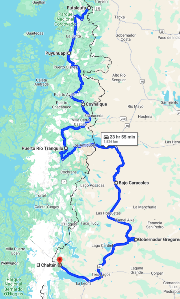
Carlsbad to Missouri City 1042 km

I’m not sure if I can make it all the way home today, I guess I will go until I’m tired…  I’ll start the trip by going on US 285 through the Permian basin unconventional oil extraction area, through Pecos and on to I10 at Fort Stockton.


The road past the Permian basin was very busy with big trucks going in both directions.  I assume carrying ingredients used in the fracturing of the oil bearing shales as well as the extracted oil.  It was very interesting to see all the activity in the area – which with other shale areas have made the US a net exporter of oil during the past 5-10 years.  It is talked about as the shale revolution!  Unfortunately for us in the seismic business there is no or very little seismic used to locate the oil bearing shales before drilling. πŸ™
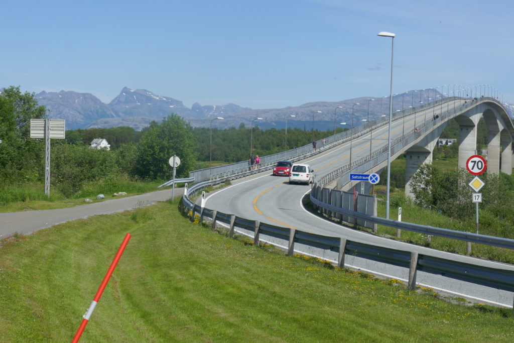
Permian basin area.

Lots of traffic and activity in the Permian basin area straddling New Mexico and Texas.

Lots of traffic and activity in the Permian basin area straddling New Mexico and Texas.


After the excitement of the Permian basin activity I rode through Pecos and onwards to Fort Stockton for fuel and food  before getting on the I10 for the treck back to Houston and home.


Russia to Sweden

Go back to The Stans post.

Atirau to Astrakhan (380 km)

It was with great relief that I got to the Kazakh/Russia border!  The last 50 km in Kazakhstan had been on horrible road where old broken tarmac was mixed with new road construction.  It was dusty and sandy in places – perhaps the worst surface for a motorcycle.

We made the optimistic plan to start at 5 am from Atirau so I got up at 4.45 and started to get ready, however, it was still dark and wouldn’t get light until closer to 6.  The “Green hotel”  served breakfast early so we had a bite before leaving a bit after 6.  The first 150 km of the road wasn’t too bad (but with deep tracks from heavy trucks) and we could keep a good speed.  As we got closer to the border the road got worse to culminate in the terrible conditions of the last 50 km.

Horrible road leading west out of Kazakhstan to Russia.

Horrible road leading west out of Kazakhstan to Russia.

Road under construction.

Road under construction.

"Donkey head" oil pumps. Must be oil under ground.

“Donkey head” oil pumps. Must be oil under ground.

Lots of free running horses along the road.

Lots of free running horses along the road.

Since we gained an hour in Russia we were at the border around noon.  My entry into Russia was straight forward but Mike’s took some time.  He had a general entry into a number of countries, including Russia, and the immigration people at this entry point had not seen this before.  After an hour we were in Russia!  The road was now beautiful asphalt and it felt like heaven! 

At one point we crossed a part of the river Volga that makes up the delta of the river as it enters the Caspian and it was a pontoon bridge made of metal, it was kind of weird as the tracks in the metal was pulling the bike in one direction.  Before entering the bridge we had to pay a toll and we had no Rubles, however, Mike’s visa card worked without problems!  Back to civilization were credit-cards and, later, ATM’s work! A big relief after the problems in, particularly, Uzbekistan to obtain cash.  Surprisingly, “Pay-wave” works where you can make payments by waving the card close to the detector machine.  Amazing!

Astrakhan 25 June, 2019

I wasn’t feeling great so I mainly stayed in the hotel but went out to see the sights and get something to eat.  I found a burger place called “Kotleta” spelled with the Latin alphabet and they served me a very nice burger.  As it happened one of the staff had a birthday and I was invited to join the celebration with tea and cake.  It was very nice and they were very curious about my trip.

Astrakhan is a nice city with lots of green parks and the “Astrakhan Kremlin” which is very close to our hotel.  

Our hotel.

Our hotel.

Lots of green parks.

Lots of green parks.

Astrakhan Kremlin.

Astrakhan Kremlin.

Birthday party!

Birthday party!

Astrakhan to Volgograd (420 km)

We’re heading towards Moscow and the first leg was to Volgograd.  Of course, Volgograd used to be Stalingrad where the most decisive battle of the 2nd world war took place with the Soviets beating the Nazis.  It was the bloodiest battle in the history of warfare with close to 2 million casualties.

Coming into the city, it looked like a grimy industrial town, but as we got closer to the center it started to look nice.  We’re staying in the center within walking distance of the Volga river and we went there for dinner and have a look around.  There’s a park along the river with lots of activities for kids and adults and there were a lot of people around.

By the Volga river.

By the Volga river.

Kids playing in the waterpark by the river.

Kids playing in the water park by the river.

Volgograd June 27, 2019

Mamayev Kurgan is a dominant height fiercely fought over in the battle of Stalingrad, now it’s a large memorial park that commemorates the battle.  It is very impressive with the big statue “The Motherland Calls” being 85m high.  It was installed in 1967 and was under renovation at our visit but the scale of it is still clear.

The Motherland Calls.
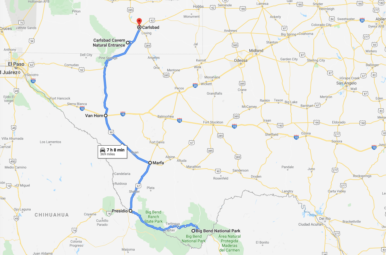
The Motherland Calls.

The eternal flame with the walls showing names of soldiers that died during the battle.

The eternal flame with the walls showing names of soldiers that died during the battle.

Changing of the guards.

Changing of the guards.

Murals depicting the street fighting nature of the battle of Stalingrad.

Murals depicting the street fighting nature of the battle of Stalingrad.

Volgograd to Tambov (520 km)

We’re getting further north and the temperature kept a pleasant 20-25 C for the duration of today’s ride.  The road was good but many stretches of road construction slowed us down a bit.  The vegetation is changing and there are a lot more birch trees and also pine trees which we have not seen before on the trip.  The road goes straight for pretty much the whole stretch over very open land and to stop the wind being too strong on the road birch trees are planted along the road to break up the wind.  The road goes in the middle in a wide swath of close to 100m with the birch trees being the boundary to the enormous wheat fields and steppe to the sides.

Birch trees planted on both sides of the road to stop the crosswind.

Birch trees planted on both sides of the road to stop the crosswind.

Finally some fir trees. Looks almost like Sweden.

Finally some fir trees. Looks almost like Sweden!

The total distance traveled so far is 13964 km and around 4000 km since leaving China.

Tambov to Ryazan (320 km)

The weather turned cold and rainy when we set off.  The plan was to go to Vladimir, 180 km east of Moscow, to attend a blues and bike festival but after 150 km in the miserable weather and worn road I decided to turn along M5 towards Moscow and stop in Ryazan while Mike carried on to Vladimir for the festival and to meet his friend.  I figured the festival would not be much fun in the inclement weather and I saw for myself a muddy field with bikes falling over in the wet terrain which also might have meant the end for my clutch..

I thought M5 meant motorway 5 but as it turned out for most of the distance it was no motorway so I believe the M stands for Moscow.  After 150 km along the M5 I turned off to Ryazan leaving around 200 km to Moscow.  It’s continued raining all day but I think tomorrow is going to be better.

Ryazan to Moscow (220 km)

It was a Sunday and the traffic was light, there were some holdups in a town 50 km from Moscow but nothing major.  My hotel is in the center of town and I rode past some of the buildings I’ve seen in the news.  Later on I walked to the red square and admired it’s buildings and the sheer size of it.  The centre of Moscow is very impressive!

The Moscow white house.

The Moscow white house.


Moscow Jul 1, 2019

I spent the day sightseeing and in the afternoon I joined a Subway tour since I’ve read the subway stations are beautifully decorated.

Karl Marx monument on the Revolution square.

Karl Marx monument on the Revolution square.

The Kremlin

The Kremlin.

Our subway tour guide, Alina, took us to several stations and explained the art in them and the history behind and since we were only three in the group we had the chance to ask a lot of questions. The subway system was started to be constructed during the 1930s while Stalin was in power.  The reason, we were told, to make such beautiful and elaborate stations was to motivate  and make people happy while going to work in the morning.  I’m not sure if it worked but it certainly made the Moscow subway a tourist attraction today!

Lenin. Alina told us there used to be a lot more pictures of Lenin previously but a lot of them had been taken down. Of course, Stalin, has been totally discredited and it's difficult to find a single picture or staue of him.

Lenin. Alina told us there used to be a lot more pictures of Lenin previously but a lot of them had been taken down. Of course, Stalin, has been totally discredited and it’s difficult to find a single picture or statue of him.

The station where the motive was related to intellectuals.

The station where the motive was related to intellectuals.

Station depicting people of all walks of life, including soldiers, students, parents and athletes.

Station depicting people of all walks of life, including soldiers, students, parents and athletes.

Moscow to Velikiye Luki (460 km)

I wanted to get out of Moscow while the traffic was light so I started a bit after 6 and was soon on the M9 highway leading to Riga.  In the beginning there were 5 lanes diminishing to a normal highway after around 120km.  I had booked a hotel at the halfway point to Riga and reached there soon after midday.  The weather was sunny but cool and I was wearing the cold weather gear.  The hotel turned out to be a motel with lots of big trucks parked and idling their engines making for a slightly noisy place to rest.

First Motel of the trip. Characterless but very practical!

First Motel of the trip. Characterless but very practical!

Velikiye Luki to Paldiski – ferry port close to Tallinn (640 km)

The weather was gray, windy and rainy for most of the time to the Russia/Estonia border crossing which I reached around noon.  The Russian official took a long time to figure out how to clear my bike out of the country and in the end his boss, a stern looking woman in a green uniform, came out and gave him an earful and soon after I was cleared to go to the immigration counter.  The woman there looked at my forms and asked me which city I lived in and I told her Singapore.  She asked; where is that – in Spain.  I explained it was in Asia and it was it’s own country and after a while she said OK, you can go.

Miserable weather on road towards Tallinn!

Miserable weather on road towards Tallinn!

So finally, in to Europe and Estonia where the immigration and custom formalities took all of 10 mins!  Amazing! After all the long border crossings in Asia it was nice to come to a place where they really knew what they were doing and being very efficient at it.  The weather also cleared up and gave me a good welcome to Europe and the 300 km to the ferry port went by pretty quickly.

I had to wait a few hours before I could board and found a nice restaurant nearby after I checked in to the ferry.  Paldiski is  right by the baltic sea and was very windy and I was afraid the bike would blow over so had to be careful how I parked it.

While waiting for the ferry I saw this home built vehicle based on a Ford V8

While waiting for the ferry I saw this home built vehicle based on a Ford V8. The couple riding it had been brave to take it to Russia.

The ferry arrived around 8.30 pm and they started to unload it.  There were very few passenger cars but hundreds of huge trucks and I was impressed to see them reversing these juggernauts from the ferry.  The ferry was emptied in about an hour and I was waved forward to board.


Bike tied down on the ferry to Sweden.

Bike tied down on the ferry to Sweden.

Kappelskar to Eksjo (400 km)

The ferry arrived early morning at Kappellskar, the port in Sweden which is about 100 km north-east of Stockholm.  Riding the bike off the ferry posed no problem and I was soon on my way south.  I stopped after a while to get some breakfast and had the classic Swedish Sibylla grilled sausages with mashed potatoes. 

Swedish fighter jets displayed along the road in Linkoping.

Swedish fighter jets displayed along the road in Linkoping. The one on the right is the “Draken” and on the left is the “Viggen”.

Gota kanal

Gota kanal

It was another windy day with some rain as I was getting closer to Eksjo but I arrived without problem at my sisters early afternoon.

Eksjo Jul 5 – 8, 2019

Spent several days in the lovely town of Eksjo.  They were clever in the 60’s and 70’s not to demolish the old wooden houses in the center of the town and it’s now a tourist attraction.  On the Saturday a marching band was playing in front of the church with a lot of people attending.

Well kept wooden houses in the center of the town which has kept it's layout for centuries.

Well kept wooden houses in the center of the town which has kept it’s layout for centuries.

A stream runs through the town.

A stream runs through the town.

Every Saturday the marching band plays in front of the church and while marching through the town.

Every Saturday the marching band plays in front of the church and while marching through the town.


Eksjo to Goteborg (200 km)

I left my sisters place around noon to catch the ferry from Goteborg to Kiel leaving at 6.45 pm.  Gray skies to begin with that gradually lightened up as I got closer to Goteborg. The road was great as it was snaking it’s way through the hills but not enough turns to make it interesting on a motorcycle.  No jams until I reached Goteborg where I was stuck in traffic for a bit before getting to the ferry terminal where I was able to board the ferry pretty much immediately.  There were around 20 bikes on the boat and I chatted with some of the riders.  One couple had spent 6 weeks riding through Finland to North cape and back and the guy said he started on a Harley but was now standing by a very new RT 1250 and I asked him how the Harley could have transformed into the very new BMW.  He said the Harley developed problems with the bearings and there was none available and somehow his insurance got him a BMW to continue his trip.  Sounds like a great insurance!  I had a cabin and after dinner I went straight to bed.

On board Stena Germanica, quite a few bikes on the ferry from Gothenburg to Kiel.

On board Stena Germanica, quite a few bikes on the ferry from Gothenburg to Kiel.

Kiel to Hook of Holland (600 km)

 The ferry was a bit late so I wasn’t able to get off it until around 10 am after a good night sleep in the nice cabin.  It seems I sleep well on ferries…  There had been some discussion while with the group in China that a carnet de passage was required for non-European vehicles entering Germany so I was relieved that there were no checks whatsoever when driving off the ferry and into the town of Kiel.  The road layout in the town was good for transiting the town and I was soon on the motorway to Hamburg.  There were a lot of roadworks around Hamburg but the traffic was still flowing well with no queues. The autobahn in Germany is fantastic and with no speed limit!  I was doing around 125 kph and was being overtaken making me feel like I was standing still!  

For short stretches the speed was reduced to 120 km/h!

For short stretches the speed was reduced to 120 km/h!

The weather was very good and I was by the Dutch boarder after 350 km around 2 pm and then it started raining which it carried on doing all the way to the ferry.  There was a lot of traffic in Holland and several jams but I made it to the ferry and, again, boarded very quickly.  I had a nice shower to warm up and had a good fish and chips dinner.  The ferry would take me to Harwich and the start of the last day of my adventure.

Harwich to Feltham close to Heathrow airport(200 km)

The main reason for going to London was so that I could ship the bike back to Singapore.  I was not able to find a shipper in Sweden and a couple of international shippers first said they could ship from Sweden but later said no.  I also had a quote to ship from Rotterdam but that was close to twice the cost of shipping from London so to London I went, although it meant spending an extra day and ferry to get there.  Anyway, the ferry arrived in Harwich on time and I started the ride to Feltham knowing I had to go on the London circular road, the M25, and as expected there were several accidents which meant the trip took a lot longer than it should have.  However, I made it to Feltham and motofreight where I was warmly welcomed.  It took me an hour to repack and get the bike ready for shipment and then I walked to a nearby pub for lunch. 

So now fly to Stockholm for three weeks of vacation before going back to the trip origin in Singapore.

Packing


People asked me how I packed and what I brought along for the trip.  The picture shows the bike with the two aluminium side bags (on a bike they’re called panniers).  Above it is the yellow waterproof bag and on  the tank the tank-bag.  I packed so that I kept everything I need at the end of the day when not on the bike in the yellow bag such as change of clothes, toiletries etc.  I kept my camera and snacks and drinks in the tank-bag so I could quickly access these needed while riding.  In the panniers I kept spare parts (bearings, levers, break pads, fork-seals, light-bulbs, fuses), tools, electric air-pump, clothes I didn’t think I would need for a few days, tent, sleeping bag and air-mattress, and rain clothes.  Also some medication like antibiotics, altitude medication, stomach upset tablets, band aid patches and some other stuff.  

I know now that I should have carried an inner tube and tools for getting the tire off the rim.  I was very lucky I was riding with Mike who had these.  I should also have brought spare clutch plates (or changed them before leaving).

Summary and thanks

I did 18500 km in 10 weeks and had an amazing experience!  It was hard work and worrying at times such as when I bent the rim so badly it did not hold air and for a while I was at a loss of what to do to carry on.  The ride through China was far too compressed and I’m at a loss to remember many of the days there while I remember the more relaxed days after China a lot better.

My bike, the Triumph 800 Xrx performed exceptionally well and started every time I pressed the start button.  It was among the most fuel efficient of all the bikes in the group through China, while still having great power to go uphill on the serpentine roads. The bike was great for 95% of the distance but for the other 5% it would have been better to have a bike with lower gearing, spoked bigger wheels with inner tubes, and longer suspension travel.  The Honda Africa Twin was used by several guys on the trip and that bike is more suitable for the worst road conditions and much more suitable for off-road use.  However, I should not complain – the Tiger got me from Singapore to London!

I thank you for having had the tenacity to follow along on my trip and hope you enjoyed my photos and ramblings.

Of course, special thanks goes to my lovely wife who gave me her blessings to go on the trip and supported me morally all along!


« Older posts